

The award-winning, six-kilometre urban cycling odyssey connecting the Cooks River to Iron Cove via brand-new tunnels, vibrant street art, and the heart of Sydney’s Inner West.
This ride is the holy grail for Inner West cyclists. What used to be a nerve-wracking maze of heavy traffic, awkward lifts, and disjointed park paths has transformed into a world-class, seamless north-south corridor. If you want to experience Sydney’s finest piece of active transit infrastructure—or just want a picturesque Saturday morning glide past eco-tunnels and buzzing local cafes—this is the ride for you.
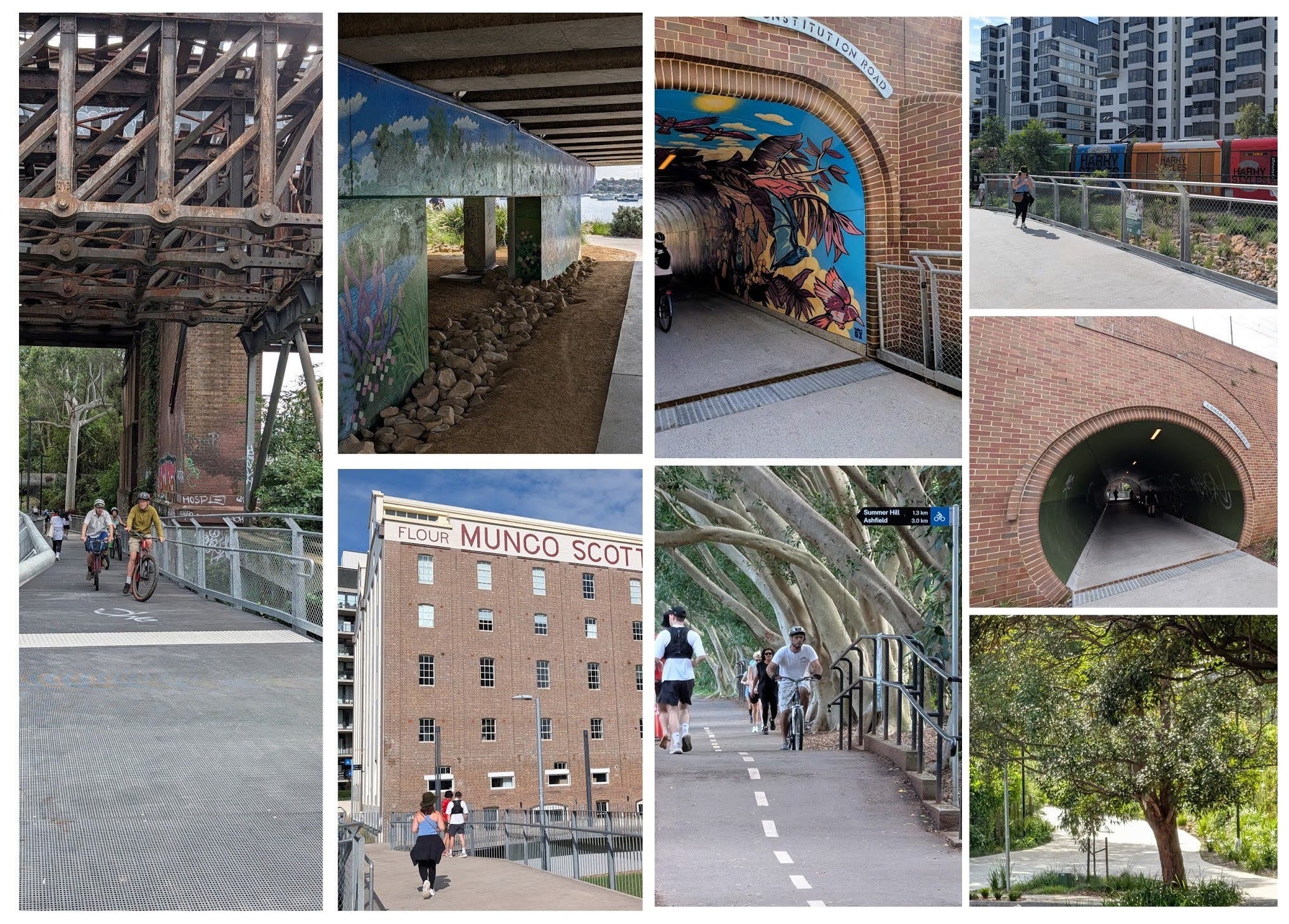
📍Here are the RideWithGPS and the CycleSydney map links
RideWithGPS Cooks Ride Collection (ride 25)
On CycleSydney Map (in Green)
This article breaks down the complete journey along Ride 25, offering a step-by-step guide to navigating the entire corridor from Ewen Park, along the new pathways, to the waters of Iron Cove. You won’t miss a single highlight—though we’d much rather you ride it than read about it 🚲.
The Pro Tips
The Transit Hack: You don’t have to commit to the full 6km return trip! Because this route shadows the Inner West Light Rail, you have built-in entry and exit points at almost every station. You can easily ride one way and catch the tram back. More than likely, that is a tactic for walkers 😁
The City Connection: Right in the middle of this route at Lewisham West, the path intersects with CycleSydney’s Ride 7. If you are commuting or just want to head downtown, branching off onto Ride 7 from here is the most direct way into the CBD.
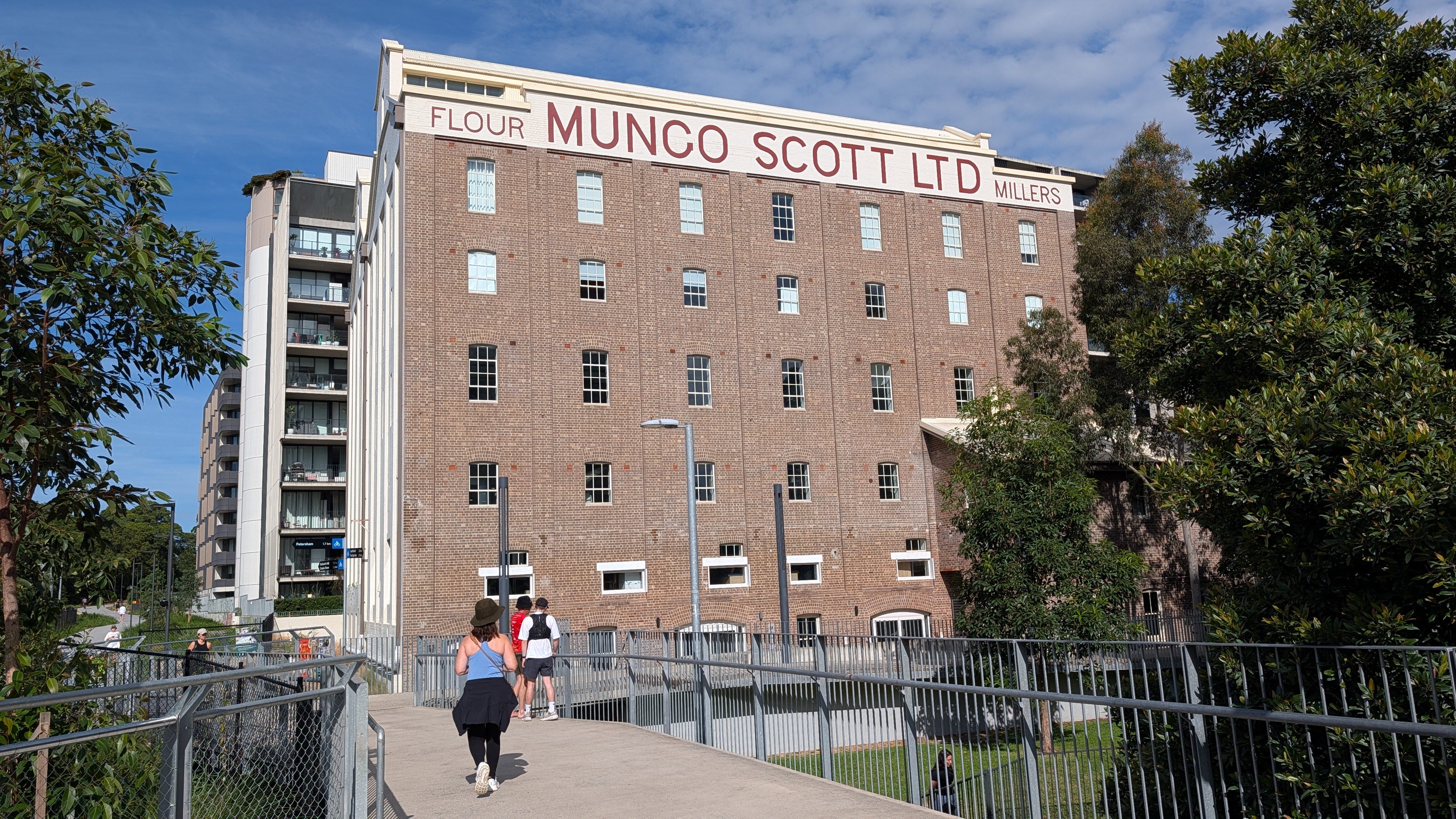
Timing is Everything: Early mornings offer crisp air and first dibs on fresh pastries in the Flour Mills area. If you are riding on a Saturday, try to hit the trail before 8 AM to beat the crowds, especially the Parkrunners that take over Hawthorne Canal at 8:00 AM. Weekdays in the arvo when kiddies are not around works well too.
Ewen Park & Lang Road Bridge
Our story begins at Ewen Park on the banks of the Cooks River. The ride starts right at the Lang Road Bridge—a modern structure with terrific rusted weathered Corten steel ballustrades. Ewen Park itself includes a brand-new skate park, open green space, and plenty of play areas for kids. After rolling north from the river (see 3D video of path above), you weave through a couple of quiet, well-signposted suburban streets, dipping under the Metro line before linking directly onto the dedicated trail.
Dulwich Hill & The “Wildlife” Tunnel
As you press north toward Dulwich Hill, the path running alongside the light rail line opens up into a spacious, smooth surface made from recycled plastic grid systems. It is surprisingly quiet underwheel and provides plenty of room for commuters, runners, and leisure riders alike.
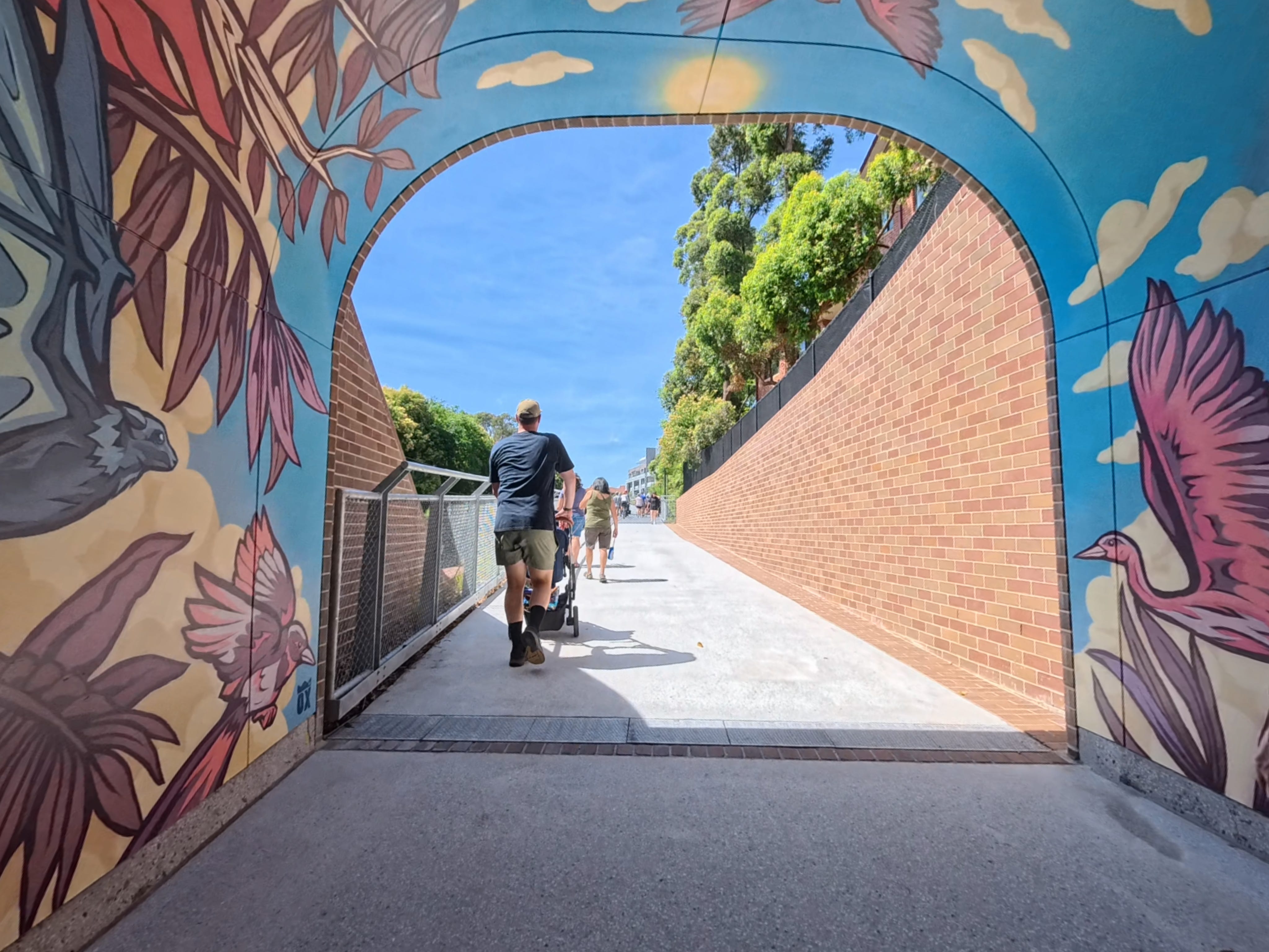
Your first major underpass takes you beneath New Canterbury Road—one of Sydney’s busiest and most intimidating thoroughfares. Instead of negotiating heavy traffic, you glide beneath it inside a stunning underpass featuring a mural titled “Wildlife” by artist Steve Nuttall. The rich brownish-blue artwork showcases native Australian birds and transforms a once-difficult crossing into a visual highlight.
“The Ghost Fungus” & Johnson Park
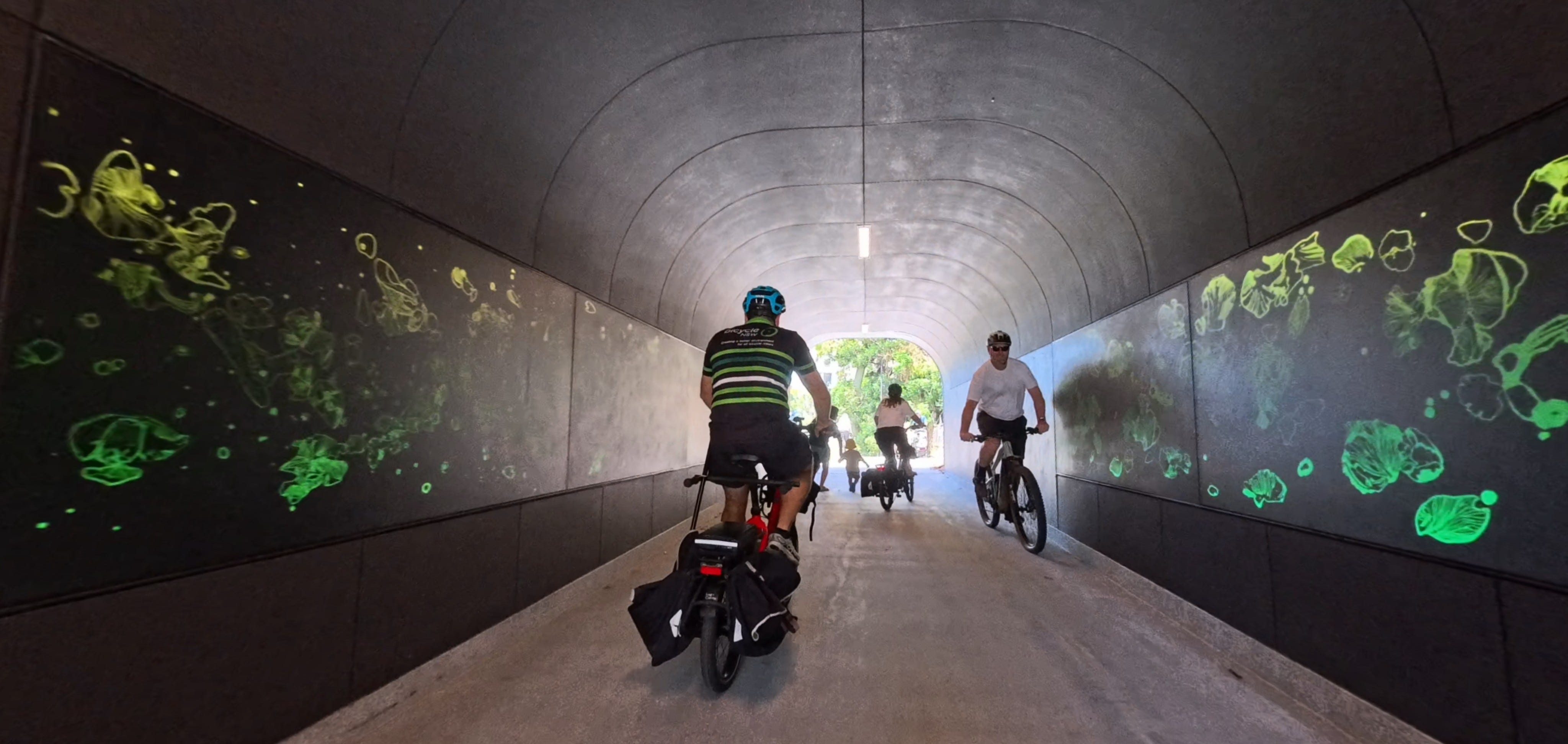
Continuing along, you enter the next eco-tunnel, featuring an artwork called “Dance of the Ghost Fungus” by Fiora Tosca. As you ride through, the walls glow with luminescent green mushrooms—a magical touch that makes you feel like you are gliding through an enchanted forest.
Emerging directly out of the tunnel, you arrive at Johnson Park, the proud host site of the official Greenway opening ceremony. This vibrant community hub features basketball courts, an expansive off-leash dog park, and clean public facilities, making it a perfect spot to pause and soak in the local atmosphere.
On-Road Charm & Old Canterbury Road
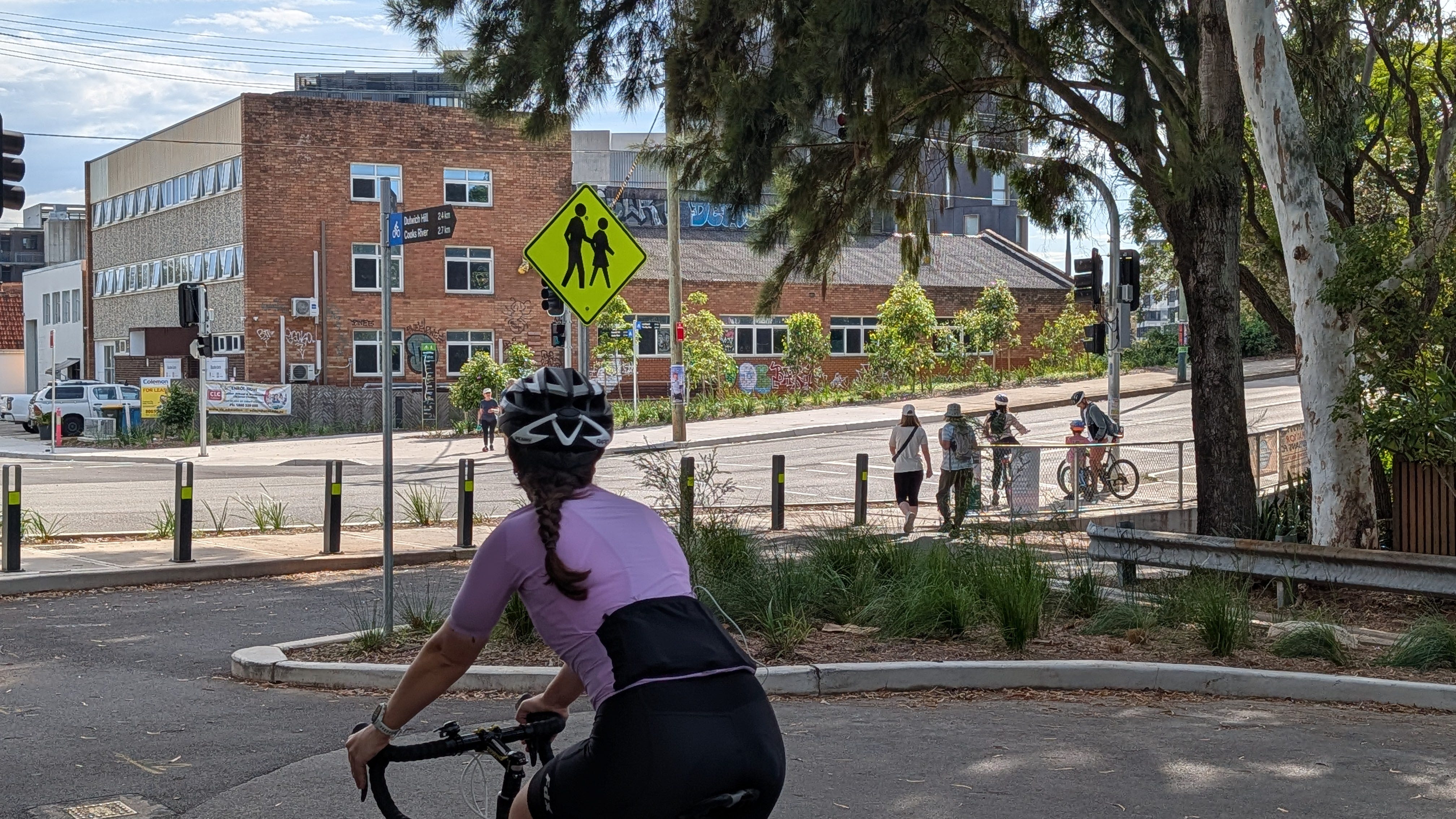
Leaving Johnson Park, the path transitions into a brief, picturesque on-road section. You weave through a series of quiet, leafy residential streets past character-filled Inner West heritage houses and neat front gardens. This short stretch of road riding that leads directly to the dedicated, signalised crossing at Old Canterbury Road, allowing you to cross over into the Flour Mills precinct.
Lewisham West & The Longport Street Tunnel
Crossing Old Canterbury Road brings you straight into the bustling Flour Mills and Lewisham West light rail precinct.
Coffee Stop Alert: On the eastern side of Lewisham West, you will find fantastic local bakery serving up warm morning pastries. On the western side, near Headlands Coffee, there are vibrant spots for an espresso or a scoop of artisanal ice cream.
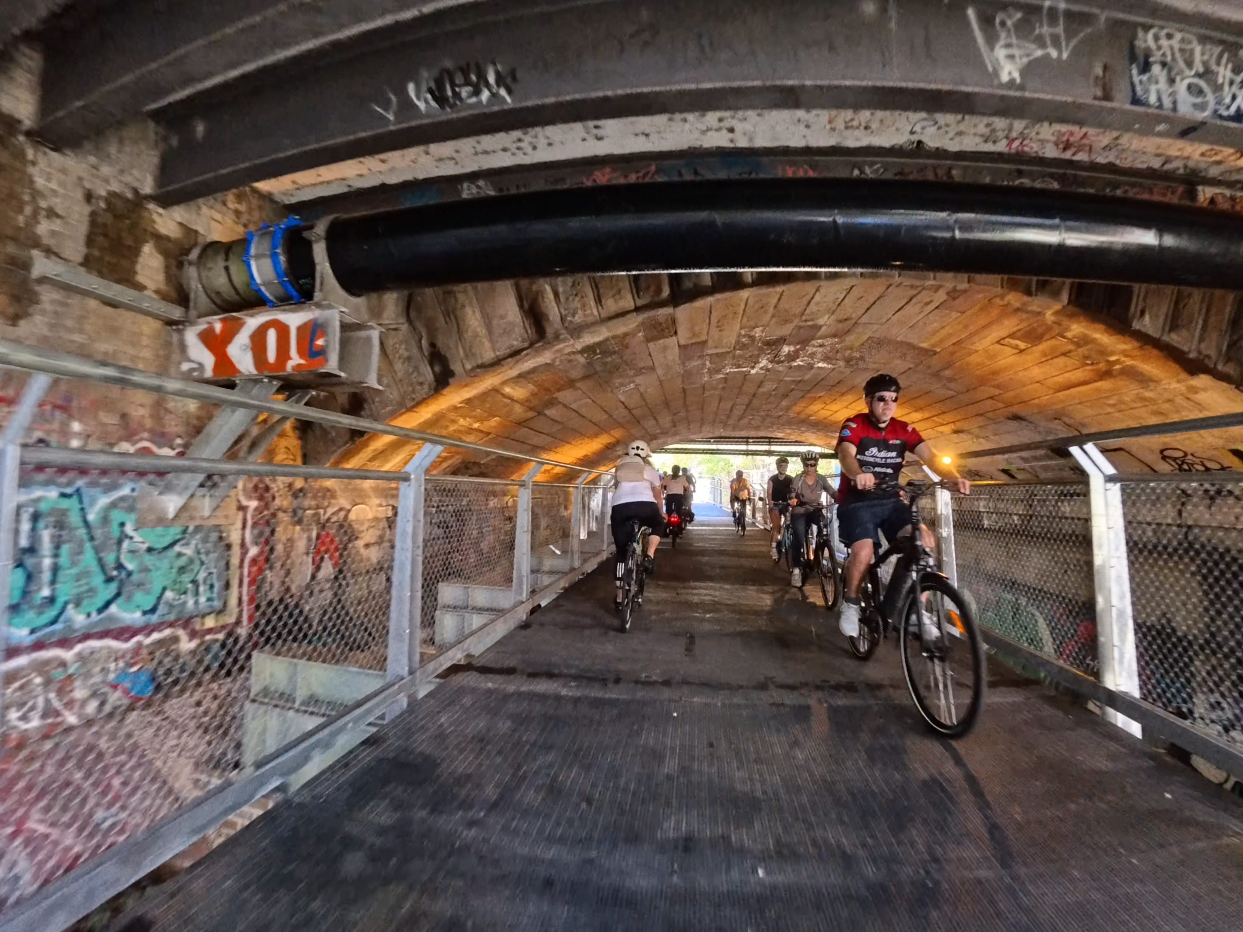
Just past the cafes lies the absolute world-class architectural marvels of this ride: The Longport Street Tunnel.
Safely bypassing the heavily congested vehicle traffic on Longport Street, this tunnel provides a direct, grade-separated connection between two key Inner West hubs—Gadigal Reserve in Summer Hill to the north and the Flour Mills / Lewisham West light rail precinct to the south.
The “Bat-Friendly” Design: A notable feature of the Longport Street Tunnel is its innovative environmental focus. The area around the Lewisham rail corridor is home to a protected colony of migratory microbats that frequent the area over the summer months. To protect these nocturnal creatures, the tunnel features a specially engineered “bat screen” at the portal. This structural barrier shields the bats’ habitat from light pollution caused by path lighting and trail users, allowing the local ecosystem to thrive alongside modern urban infrastructure.
Technical Features: Built as a wide, 20-metre-long mined concrete tunnel running into a 3.5-metre-wide shared path in a cavern beneath the main suburban railway lines to Strathfield, it is a historical piece of civil engineering. As you pause inside, you can look up to see towering gum trees, vintage rusty rail structures, and utility pipes covered in colorful street art—all while hearing a city-bound passenger train thundering overhead.
Parramatta Road & Taverners Hill
For years, crossing Parramatta Road was the bane of every Inner West cyclist’s existence—requiring awkward elevator trips or navigating tight pedestrian bridges. The newly opened central section solves this completely with a smooth, wide underpass.
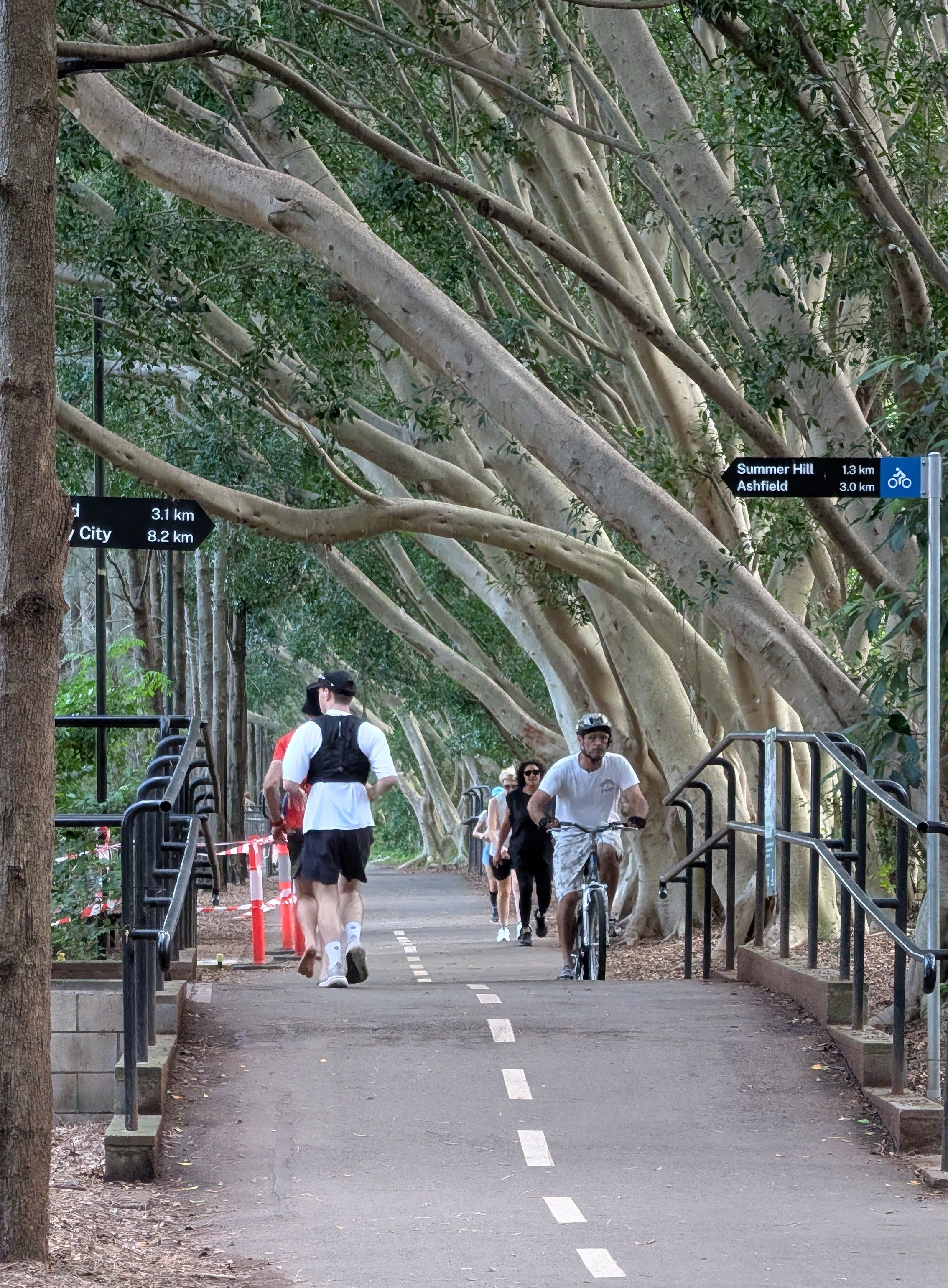
Passing Taverners Hill light rail station, the path meanders through stands of silvery gum trees along a concrete drain that looks better at high tide. While tree roots give the older sections a bit of character, the newly constructed bridges and grid paths make the journey effortless. At Marion Street cyclists enjoy fast buttoned crossings.
Hawthorne Canal & Richard Murden Reserve
Beyond Marion Street, the old storm drain widens into the picturesque Hawthorne Canal. The trail winds along Richard Murden Reserve in a gentle, winding three-metre-wide concrete paths. This stretch is brimming with community activity:
Sports & Recreation: Over ten netball courts, newly resurfaced basketball courts, and a popular tennis complex.
Dog Lovers Paradise: An expansive off-leash dog area where you are guaranteed to spot a hundred happy poodles.
Family Playgrounds: A 100-metre-long adventure playground with timber climbing frames, Sandstone block seating, a rotunda, and modern amenities blocks.
The Grand Finish at Iron Cove
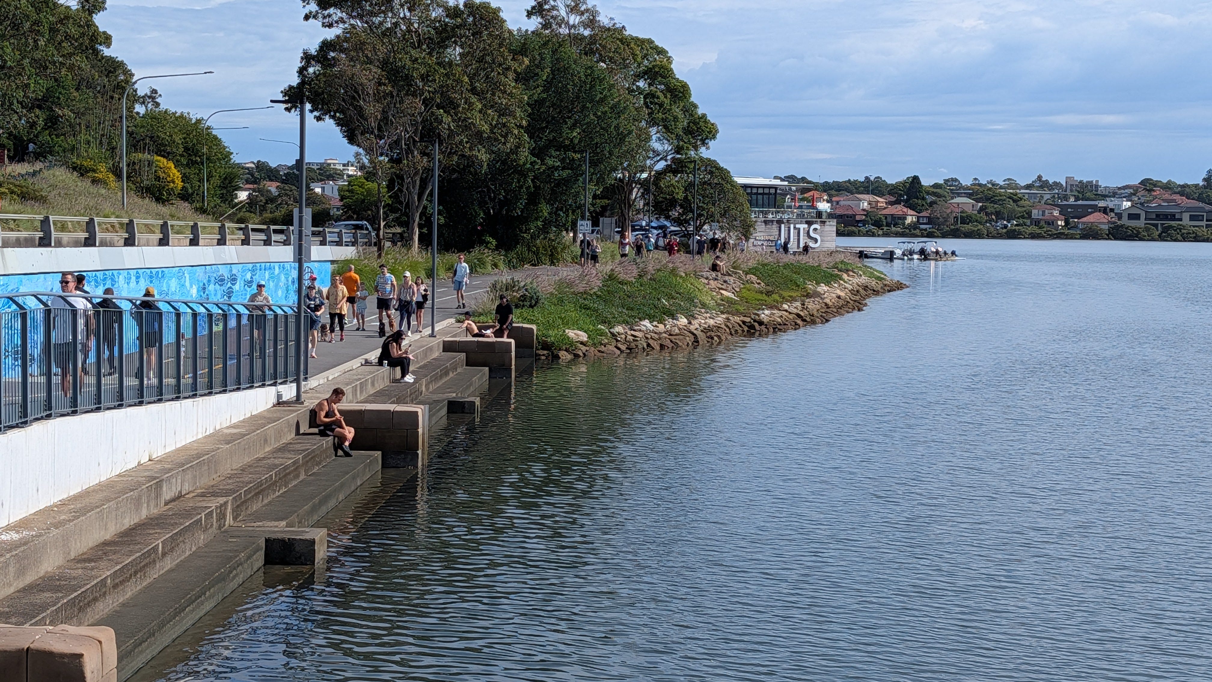
As you approach within 300 metres of Iron Cove, a sleek concrete bridge carries you across the water toward the final leg. The ride concludes with two spectacular final underpasses beneath the western arterial roads, bringing you out onto a brand-new, extra-wide walkway bridge equipped with public bike pumps and repair stands.
Looking out across the water, you can watch the UTS Rowing Club boats slicing through the bay. From here, you can seamlessly connect toward Lilyfield Road or loop onto the Bay Run for eight more kms.
Why This Ride Matters
Having spent over eight years mapping every corner of Sydney—from the 220km Greater Sydney Bike Trail to quiet suburban lanes—I can confidently say that Ride 25 represents the absolute best of our city’s transit future. It connects neighbourhoods, fosters local community, and proves that thoughtful design can turn busy urban barriers into peaceful green corridors. See Garry interview on YT
The Greenway won the 2025 Infrastructure Awards!
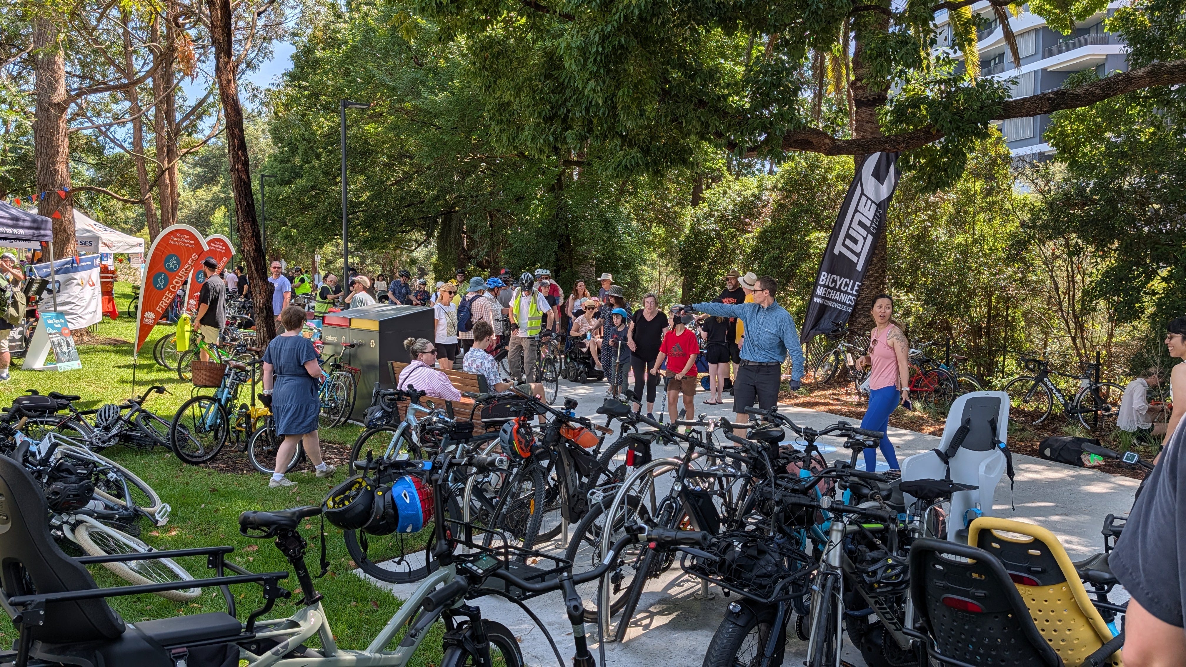
Having run the Sydney Cycling Infrastructure Awards since 2018, I was thrilled to crown the GreenWay as our 2025 winner! 🏆🚲 Check the Infrastructure Awards page here
It faced tough competition from the Oxford Street West cycleway and 📹 the red bridges of Muddy Creek, but the sheer transformation of this route was unmatched. Bypassing major arterial roads to link two iconic waterways made it a once-in-a-generation win for the city. And did I mention how popular it is, very !
Further Resources & Maps
Inner West Council 🔗 Official Greenway Portal: The best spot for downloadable precinct maps, accessibility information, and public art locations.
Rail Trails Australia 🔗 Cooks to Cove Guide: A great read for history buffs tracing the corridor’s evolution from the 1914 Metropolitan Goods Line.
Inner West Guide 🔗 The Greenway Guide: A handy local directory focusing on walking itineraries, parking locations, and family amenities.