
Eastern Suburbs
Eastern Suburbs of Sydney

Future Eastern Suburbs content including RideWithGPS will be found using this page link cyclesydney.com/p/east
Lots of ridewithgps info and more videos to decide if you want to explore the area east of Sydney
The Eastern suburbs of Sydney offers many cycling opportunities and attracts a lot of cyclists. Riding around and staying away from cars is difficult, hopefully this page will help you out. The easier way is just to ride early Saturday or Sunday morning before everyone heads out for morning coffee. Jump to read about La Perouse and other southern rides in the east like Malabar, Doncaster Rd Bondi Junction, Mascot and Pagewood, Sydney Park and Glebe.
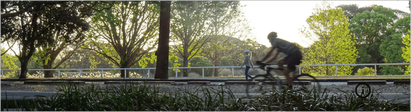
Centennial Park
Everyone rides the 4km loop (see pics) at Centennial Park. Its great because you don’t have to stop often and you have 4m of bike zone. Best place to start your cycling in Sydney’s East. Lets see the park, how to get there and all the others places people ride to in the Eastern Suburbs. Read More about Centennial Park and Queens Park here
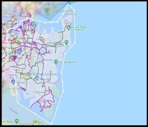
Eastern Sydney and City Map >>
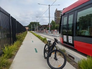
Bondi Junction Cycleway
One of the great achievement in 2022 was the completion of the Bondi Junction cycleway 3rd Place.
Some Links to Eastern Suburbs articles
Racing the tram from Randwick to Circular Quay
Alexandria to Darling Harbour Precinct beat-the-bus-no-5/
Randwick to Marrickville faster than a bus ?
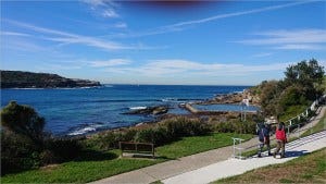
La Perouse

If you want to ride 10km and see a fort, beaches, wharfs, a cemetery and East Sydney’s latest kids park, head to La Perouse. See the the trail on the Eastern Sydney map >>

See plenty of photos of the great Yarra Bay beach and nearby Prince of Wales Drive With kids and teens, start at the new Chifley Sports Reserve on Bunnerong Rd. There is a 1 km double lane track around two ovals and a great kids playground and even a skate park. If you actually want to going riding. Safely cross Bunnerong road and head down to La Perouse and Bare Island Fort. It is a spectacular place and lots of wedding photos are taken there. Head down past the fish and chip shops and soon you will be in La Perouse Park. Follow the coast around the bays and past the Botany Cemetery. You can take a up-back on Prince of Wales drive for an extra 4km. Return to your car at Chifley Park down Military Rd and you will have had 10km of pretty safe fun. Notes: Its shared path all the way and only a few road crossings. There is one bumpy section of 200m on the coast. Pretty easy really. When you finish, head to Botany and ride another few km at Sir Joseph Banks Park. That is another kid friendly park. And Heffron Park is not far away >>
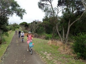
The Malabar Loop
This is a Sydney Top 10 trail – Just one of those casual rides that keep people flocking to this corner of the East. Ride details here See the the trail on the Eastern Sydney map >>
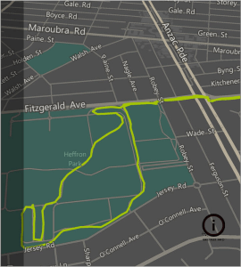
Heffron park
Heffron park is the park you go to when you know Centennial is going to be too busy or you just want to ride hard with no hassle. There is a historic race track that fills the centre that has some slow banked curves plus a nice concrete trail for bikes around most of the outside. Its great for kids on these tracks and there is even a mini kids traffic light area at the southern end of the park. Here is a map of Heffron and the Malabar Loop >> If you want to include a meandering ride along Maroubra beach, start at the northern end of Marine Pde and make your way along the footpath down to the beach and then head up Fitzgerald Ave. If there are people on the path, they have right of way. After crossing Anzac Pde, you will soon find yourself at Heffron. Note: Parking at Heffron is always easy at the northern end. Photos of Heffron Park External Links Randwick Council Bicycle Page
Botany
Sir Josephs Banks Park in Botany is a nice little place to ride for 45 minutes.
There will be more about that as an extra for Ride 18 Botany to Zetland
Mascot Pagewood
Commuter Path from Mascot Station into Botany and around to Pagewood.
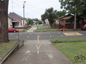
There is a decent bit of protected track on the edge of Wentworth Avenue that runs under the M1 (South Dowling Street on the edge of Mascot). If you are happy commuting down the painted line cycle paths on the roads and through back streets, you can get to this path. Then you will get into the quieter streets of Botany and Pagewood and even a better path or two. This page is just to show you where to go if you were to commute to these parts of Sydney from the important junction of Mascot train station on Coward St. From there you can head to Brighton and even to Strathfield if your legs will carry you that far. The Botany map stops just over the tricky to find pedestrian and bike bridge. The Pagewood trail I have outlined goes through Mutch park and down the popular commuter bike road Banks Avenue in Pagewood and ends up where the tram line will start in Kingsford. Here is the Mascot to Kingsford trail >> and Photos of the trail
Mascot to Zetland On a Sunday morning, this road through to Zetland is pretty free of cars and is really nice to ride. Mid week it will be just a car road. It ends up being almost a straight line to Redfern Station. The trail uses Dunning Avenue and Portman street and ends up at Green Square station. Photos from Mascot to Zetland and Here is the route from Mascot to Zetland >>
Note: Where Bowden St crosses Bourke Rd, there is now a mostly completed cycle path into Green Square >>.
All the Eastern Suburbs videos here. Find your inspiration
The new CycleSydney Map launchpad

We’ve been working on a simpler way to get our cycling maps onto your phone while you’re out exploring. We’ve just set up a new “Launchpad” to make the process of getting cycletrails in the background of Google Maps easier. Think green lines with lots more info.