

This 12km ride connects Padstow and Riverwood across Salt Pan Creek, along the M5 Linear Path, through backstreet climbs in Earlwood, and along Cup and Saucer Creek to the Cooks River. Featuring Sydney’s longest section of mangrove boardwalks, concrete cycleways, and neighbourhood backstreets, it links South-West Sydney directly to the inner-west waterways. Let’s cycle! 🚲
Here are the statistics and key details for this ride: Distance: 12.0 km. Elevation Profile: Minimum 5 m (yes nearly sea level many kms inland), Maximum 55 m (Total climb: 80 m, Total descent: 85 m). Ride Terrain: Mixed concrete and bitumen cycleways, 100m of wooden boardwalks, and residential backstreets.
📍 Here are the maps and files for this ride:
RideWithGPS: Cooks Ride 28 (Download the ride GPX here)
RideWithGPS Collection: Cooks River Series
Network View: On the CycleSydney Map

Salt Pan Creek to John Mountford Reserve
This ride begins near Padstow Railway Station and the Padstow Bunnings store, where Salt Pan Creek forms a wetland. Roll down the bumpy path and onto the timber path leading into the wetlands.
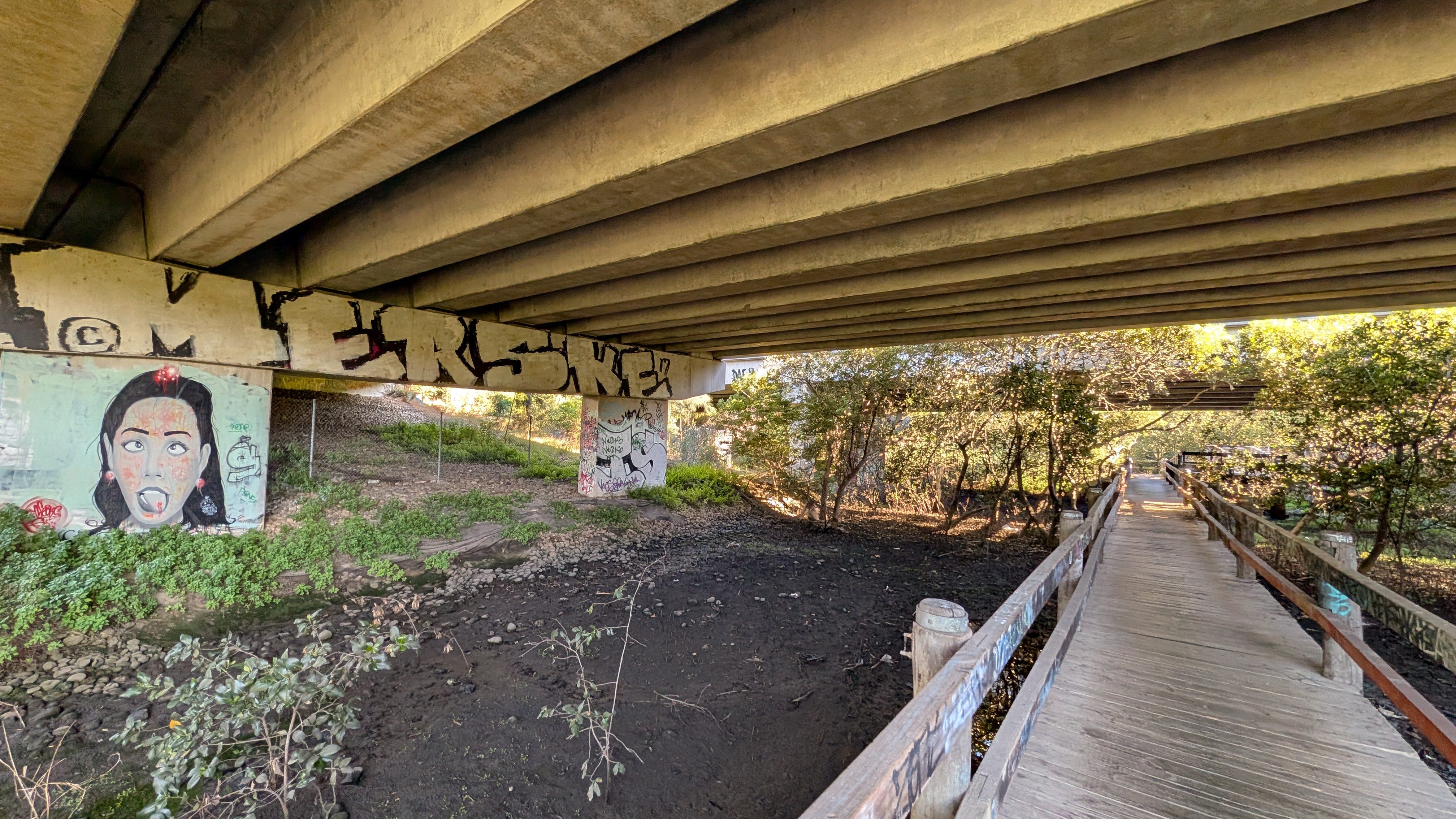
You will soon reach the wooden bridge spanning Salt Pan Creek directly underneath the concrete spans of the M5 freeway. This bridge was damaged by vandals in 2021 and reopened in 2023. Riding just north of the freeway while traffic thunders overhead on some sketchy wooden boards shows the local politicians prefer white limos to family bicycles. You emerge at McLaughlin Oval.
Past McLaughlin Oval after exiting the boardwalks, pass through the pedestrian tunnel beneath the M5. As you emerge onto the wide concrete cycleway, you will notice a prominent hill rising in front of you—Salt Pan Creek Reserve, a remediated former municipal landfill site closed in 1978. I will spare you the history of a rubbish dump.
Side Note: At Salt Pan Creek you encounter nearly 1.5 km of winding wooden mangrove boardwalks. Due to narrow timber decking and council regulations, cyclists are required to dismount and walk their bicycles through this section. Walking here is a better experience as you navigate through one of Sydney’s largest intact mangrove boardwalk ecosystems.
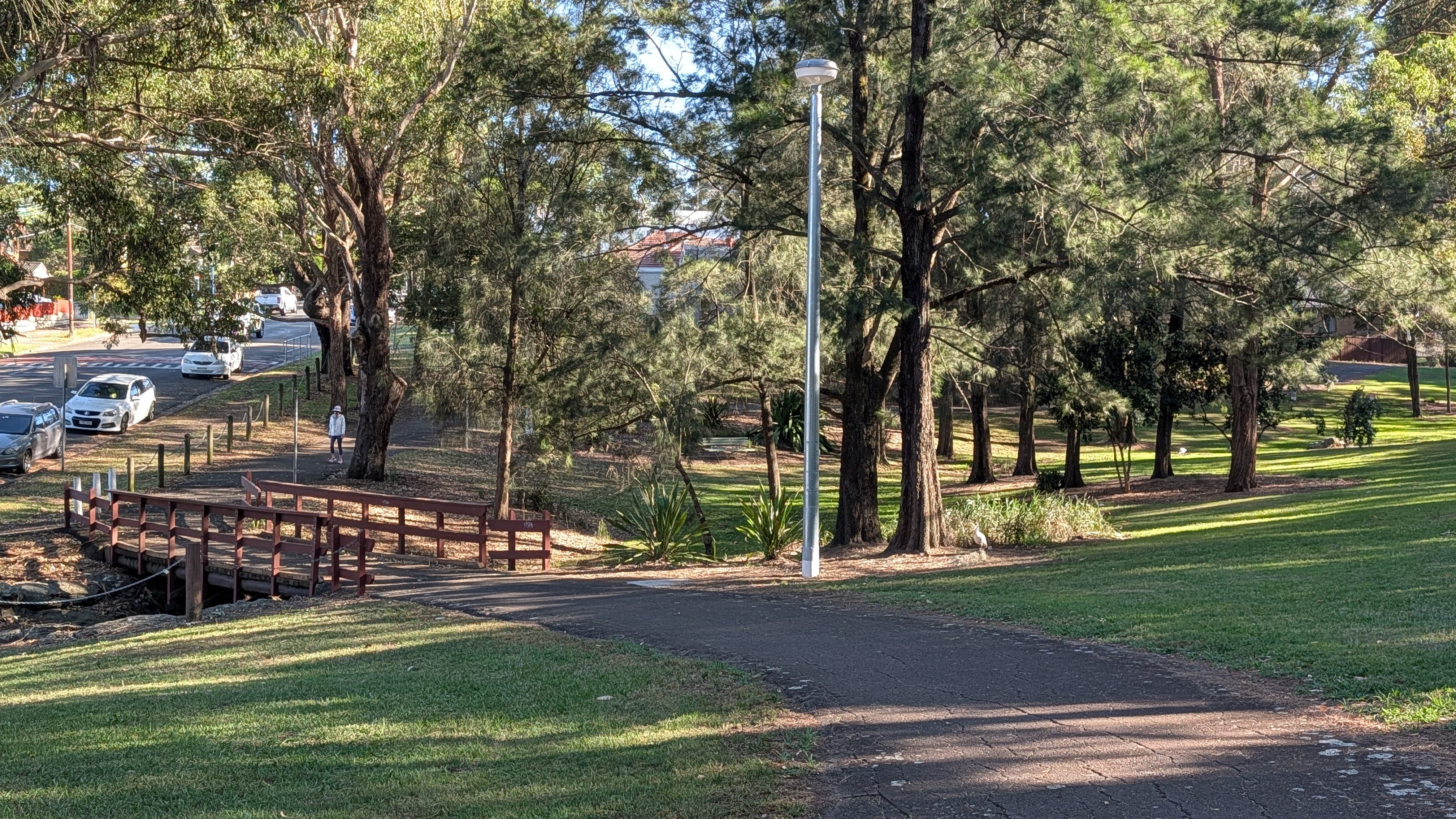
Follow the concrete paths past the Riverwood Wetlands, a man-made lake populated by ibises, ducks, and geese. If you check the CycleSydney map, you will see riding options to Oatley Park and Alfords Point Rd and the GSBT. Bypass the nearby skate park, navigate around the Riverwood Community Centre, and cross Belmore Road using the dedicated bicycle signal crossing. The path continues past the Morris Iemma Indoor Sports Centre and leads past a lovely Lance Hutchinson Oval.
Take care when crossing Bonds Road. From here, a tarmac pathway guides you through a series of local reserves, including Windarra Reserve. To cross Punchbowl Road safely, head up toward Perry Avenue to where sightlines are clearer. Once across, travel under the M5 and arrive at John Mountford Reserve.
Local Secret: If you are riding with young children or prefer a shorter family outing, around the Lance Hutchinson Oval and the Riverwood Community Centre are excellent alternative starting points with roughly 3 km of mostly off-road cycling.
M5 Linear Path
From the northern side of John Mountford Reserve, follow Woodlands Avenue and turn onto Shorter Avenue. Proceed with care as you approach the intersection with King Georges Road, a busy arterial corridor in the region. Cross King Georges Road via the pedestrian signals, use the footpath for 15 meters and head down Alambie Crescent to join the northern side of the Linear Path.
The M5 Cycyleway (Linear Park) was upgraded in late 2020 with wide concrete paths, this dedicated cycleway sits below the level of the motorway, keeping it sheltered from vehicle traffic.
As you travel east along the cycleway on the north side, you will pass Canterbury Golf Club and pass near the disguised chimney stacks serving the tunnel network. Pedestrian tunnel murals line active tunnels beneath the motorway and these are featured in this video of the 6kms of cycleways (3 up and 3 back).
Upon reaching Kingsgrove Road, cross to the southern side of the M5 as it is quicker than the 2 crossings to get to the north side. Here, the cycleway features public art installations, including sculpted heads elevated on poles above the trail. You can see the statues in the art video above.
M5 Linear path was unveiled in the pandemic in 2020 against very good competion in the Infrastructure awards. Prize winners that year were 1st Place – Bare Creek Mountain Bike Park (Belrose) , 2nd Place – Lachlan’s Line Bridge (Macquarie Park) , 3rd Place – Henderson Road Popup to Redfern Station.
M5 to Cup and Saucer Reserve
Exit the M5 cycleway at Lundy Avenue to begin the backstreet connection linking Earlwood and Bexley. This section includes a climb as you cross the ridge separating the M5 corridor from the Cooks River valley.


Follow local bicycle street markers up Pool Street, turning left onto Woolarie Avenue past the local school. Continue straight across William Street onto Ferrier Parade, where sharrow road markings indicate the way.
As you reach and head down Jarrett Street in Clemton Park, motor vehicles are restricted to turning left or right into Bexley Rd, but bicycles are permitted to proceed straight ahead through the intersection. This traffic management design reduces through traffic, creating a calmer passage for cycling.
Cup and Saucer reserve (Pat O’Connor Reserve)
At Northcote Street, roll onto the dedicated path marking the start of the Cup and Saucer Creek cycleway. The environment transitions from residential streets to parkland corridors.
The pathway skirts around local ovals and crosses Cup and Saucer Creek, following the western bank along an established track. As you ride north toward Fore Street, the pathway transitions into a concrete cycleway alongside the restored creek line.
This video of early journeys along the Cup and Saucer Creek pathway is one of my favourites. The parks are a quiet place to cycle compared to the busy Cooks River, give the Cup and Saucer a go one time.
Arriving at the Cooks River
Reaching Fore Street, follow the short connecting path and turn left into Woodgate Street. Proceed downhill past the timber power pole, emerging at the banks of the Cooks River.
To complete the ride, prepare to cross the Cooks River via the wooden footbridge. At the bridge entrance, you will find a timber street library where locals exchange books.
Important Note: In accordance with posted bridge signage, cyclists should dismount and walk their bicycles across the wooden bridge over the Cooks River. See a video of the final section here
Extensions
From the Cooks River footbridge, you can connect directly onto the main Cooks River Cycleway. Heading west leads toward Campsie, Strathfield, and Olympic Park, while heading east leads downstream toward Canterbury, Marrickville, and Botany Bay. Alternatively, you can connect north toward the GreenWay to reach Summer Hill and Iron Cove.
Final encouragement: Get out and explore South-West Sydney’s green corridors!
Pack your helmet and explore this 12km journey on Cooks Ride 28! From the mangrove boardwalks of Salt Pan Creek to the M5 Linear Path and Cup and Saucer Reserve, this ride showcases suburban green links in Sydney. Respect the walking zones, observe the public art, and take in the river views! 🚲
Ride safe: Infrastructure and signage can change over time. Always pay attention to your surroundings and respect local council regulations.