This ride delivers a mix of purpose-built cycleways, quiet suburban backstreets, leafy creek corridors, and one of Sydney’s most dramatic harbour bridge crossings. Starting on the north side of the Parramatta River and winding through historic reserves, flying fox colonies, and suburban parklands before taking on the massive arch of the Gladesville Bridge, it is an essential link connecting the northern suburbs to the inner west. Let’s cycle! 🚲
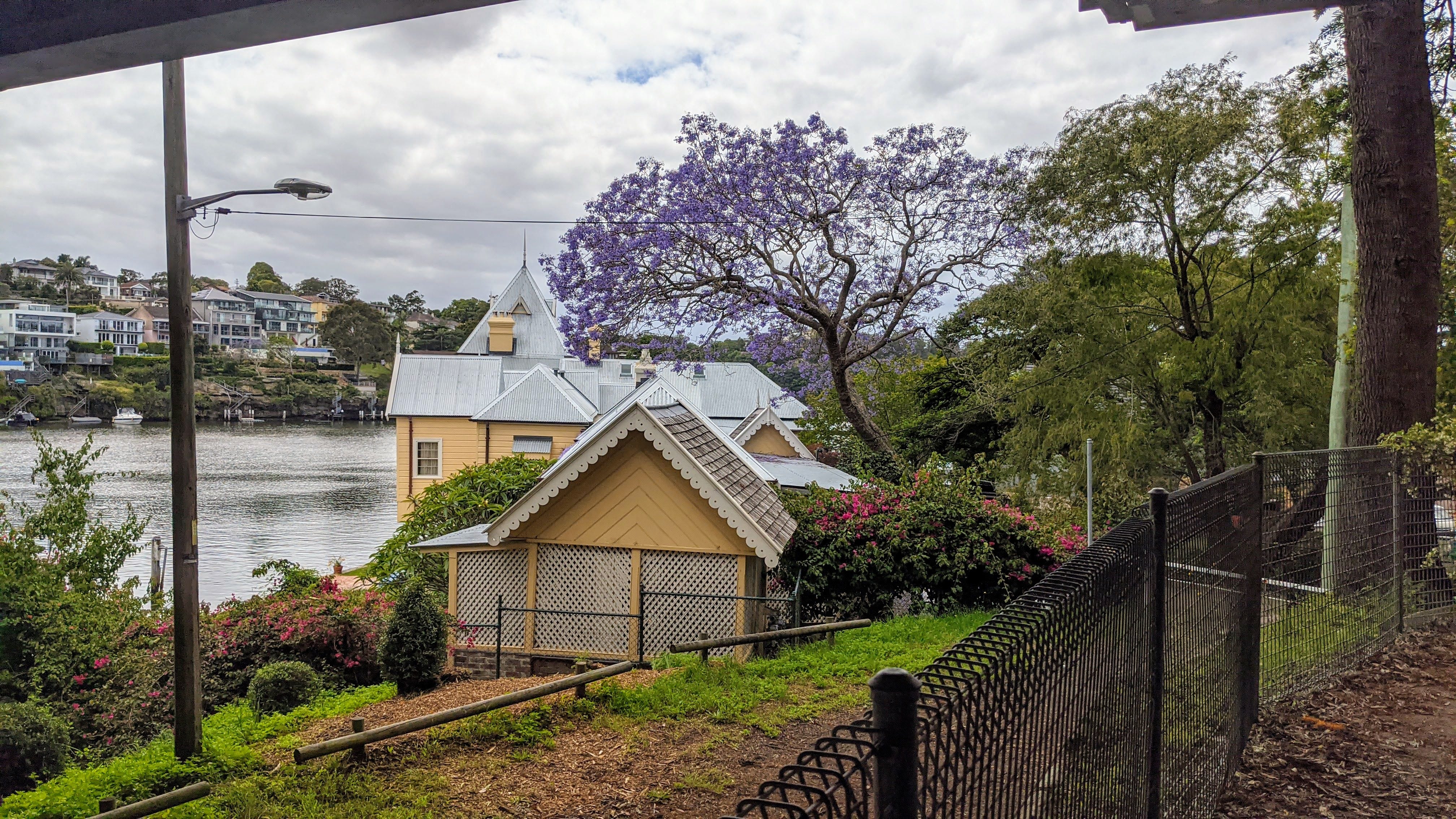
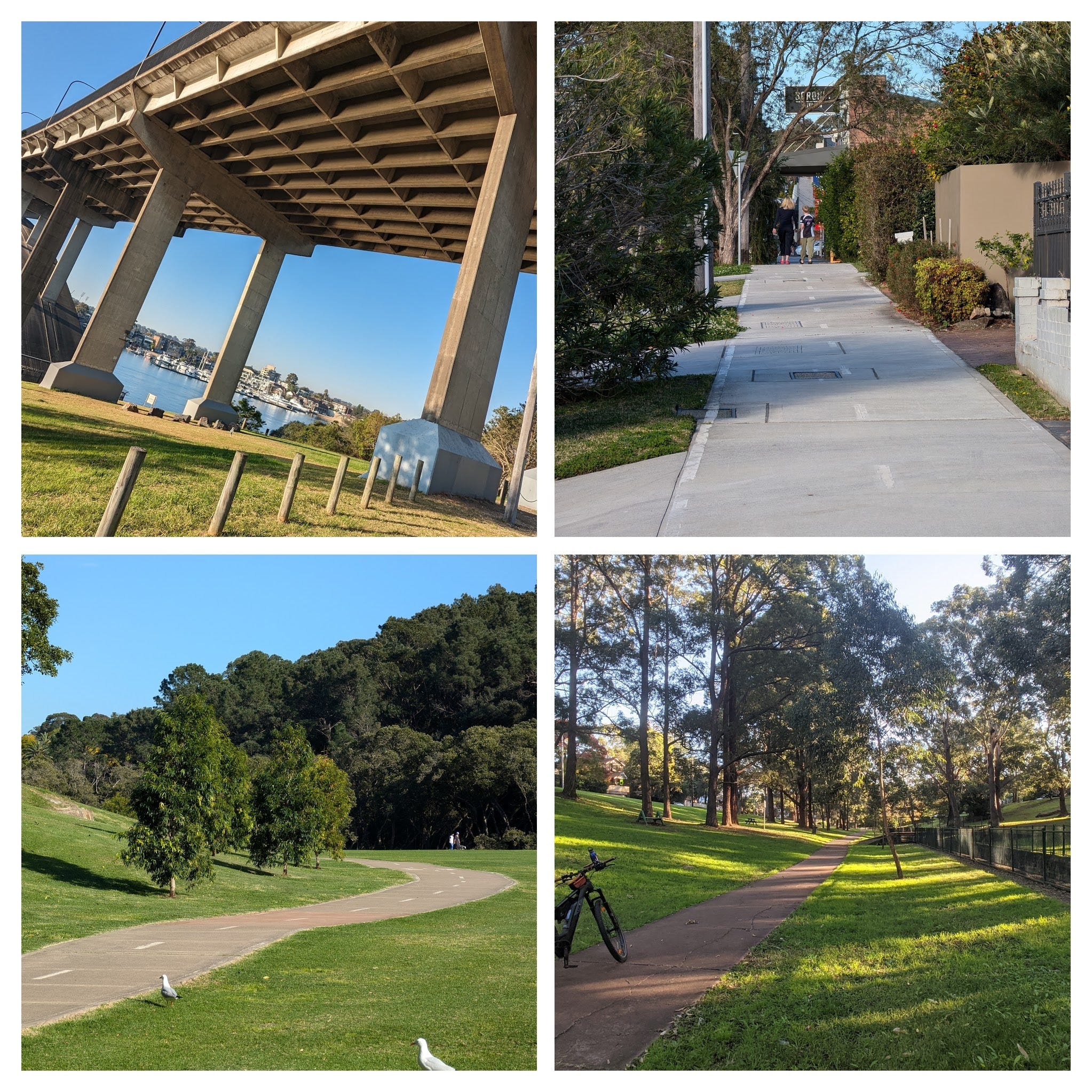
Ride Highlight - Carisbrook House - Beneath Burns Bay Road Bridge
Downhill Runs and Creek Reserves: North Ryde to the Field of Mars
This ride begins in Lane Cove on Epping Road. You set off on Pittwater Road, directly across from the corporate office blocks and the North Ryde Metro station.
The first 600 metres roll along a dedicated shared path situated about five metres off Pittwater Road, twisting and turning under a canopy of lovely trees. When you reach Magdala Road—right on the corner where the North Ryde RSL stands—cross over to the western side of Pittwater Road where the shared path cycleway beckons.
(Local Link: If you decide to peel off down Magdala Road toward the river, you can follow an alternative cycleway and bridge over the Lane Cove River that loops back up to meet Epping Road cycleway).
On the western side of Pittwater Road, you’ll follow the cycleway all the way down Strangers Creek toward the Field of Mars Reserve. Right across the road at the bottom of the hill sits Buffalo Creek Reserve, which features a miniature “learn-to-drive” track for young kids on wheels.
Going down Pittwater Road, the gradient gets quite steep. While confident commuters often opt to take the road on the descent down to the valley, anyone heading north up the hill will definitely want to stick to the shared path—there is simply no way to keep pace with traffic at an uphill crawl of 12 km/h!
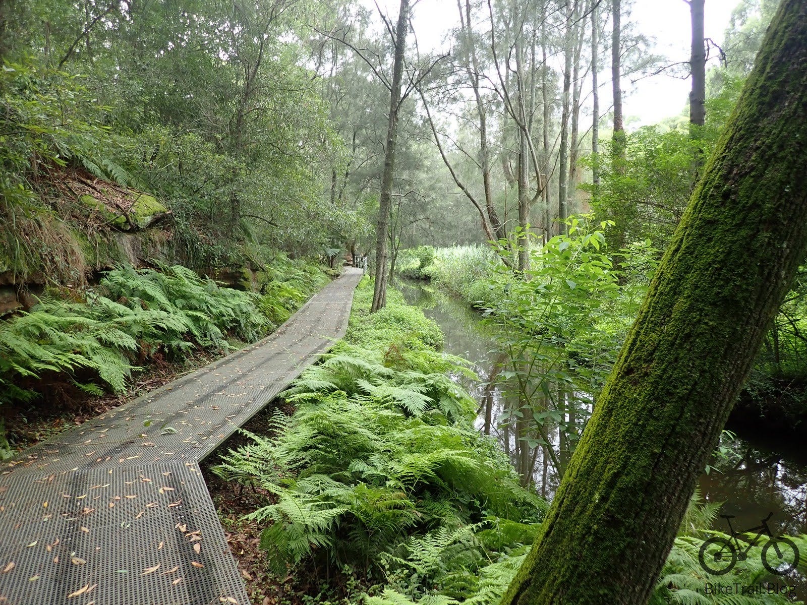
The lush greenery of the Field of Mars and Strangers Creek - not for cycling
Cafes, Flying BMX and Flying Foxes: Boronia Park to Tarban Creek
After skirting the Field of Mars, the path heads uphill again on another steep shared-path climb. As you top out and reach Boronia Park, you’ll spot a wonderful local cafe right as you enter the small village shopping centre.
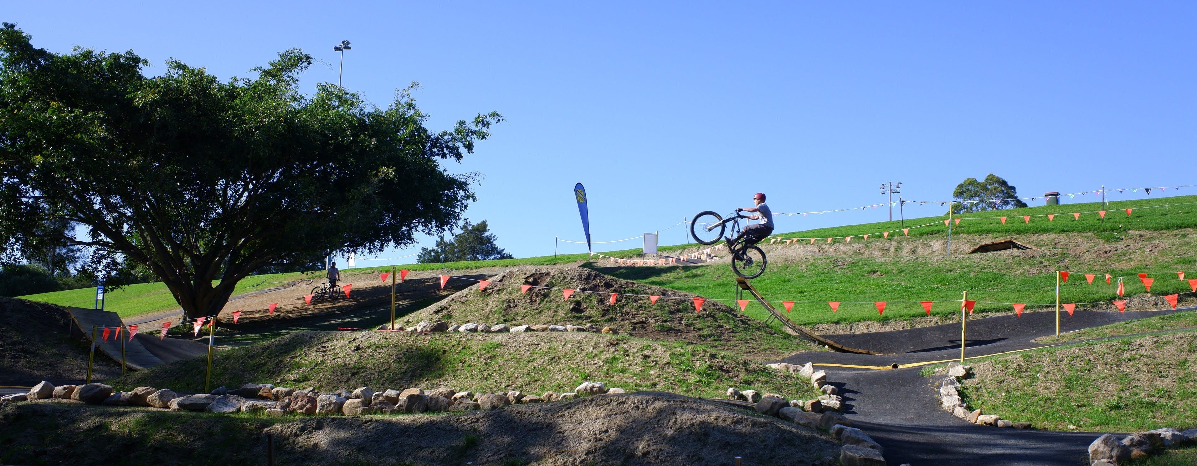
Turn onto Princes Street and roll down toward the park grounds, before turning right to follow Park Road and Augustine Street. If you have competant teenage riders in tow, Boronia Park features a small BMX dirt track with jumps to explore.
Crossing Ryde Road requires extra caution: use the pedestrian crossing, take it slowly, and keep your wits about you because the crossing sits directly on a corner. From there, roll down past the sprawling, historic grounds of St Joseph’s College.
You’ll be riding on-road here as you tackle a decent descent into Tarban Creek. Just before hitting the bottom of the hill at the Gladesville Road crossing, look out for a small access ramp on the right that leads down and under Gladesville Road.
This ramp delivers you to the Tarban Creek cycleway. After rolling for about 400 metres, cross Manning Road and head over an old wooden bridge. Look up into the canopy—the bridge and surrounding trees are home to an incredible roost of around 8,000 native flying foxes (they stink) !
View from Burns Bay Road Bridge on Tarban Tarban Creek
Bridges, Tunnels, and Archways: Tarban Bay to Huntleys Point
The cycleway hugs the creek all the way down to Tarban Bay. From the water’s edge, you wind your way back up the hill on a winding shared path.
Take special care on the wooden bridge located on a very sharp bend along this climb: if the timber is at all damp or wet, dismount and walk, as the surface becomes treacherous and slippery. If you are riding an e-bike, do not engage high pedal-assist or heavy gears here, or your rear tyre will spin out instantly.
Follow the path up the rise to Baruda Place as the ride heads east toward the Parramatta River. At the crest of the hill, a narrow shared path guides you directly through and underneath the Burns Bay Road Bridge, providing a dramatic view looking out over an exquisite heritage waterfront home on the eastern side.
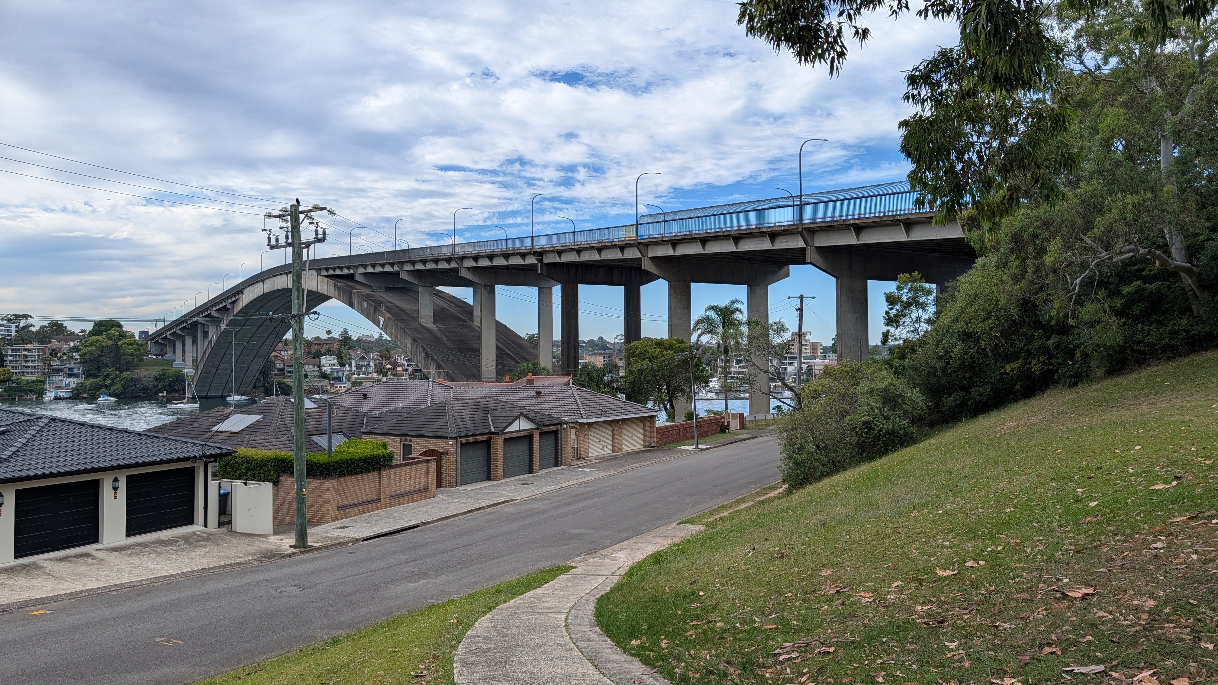
Pop out onto Huntleys Point Road—a quiet no-through enclave—and follow the curve of the road around until the massive structure of the Gladesville Bridge looms into view.
Gladesville Bridge, Boronia and bottom two, Tarban Creek
Tackling the Arch: Gladesville Bridge to Drummoyne
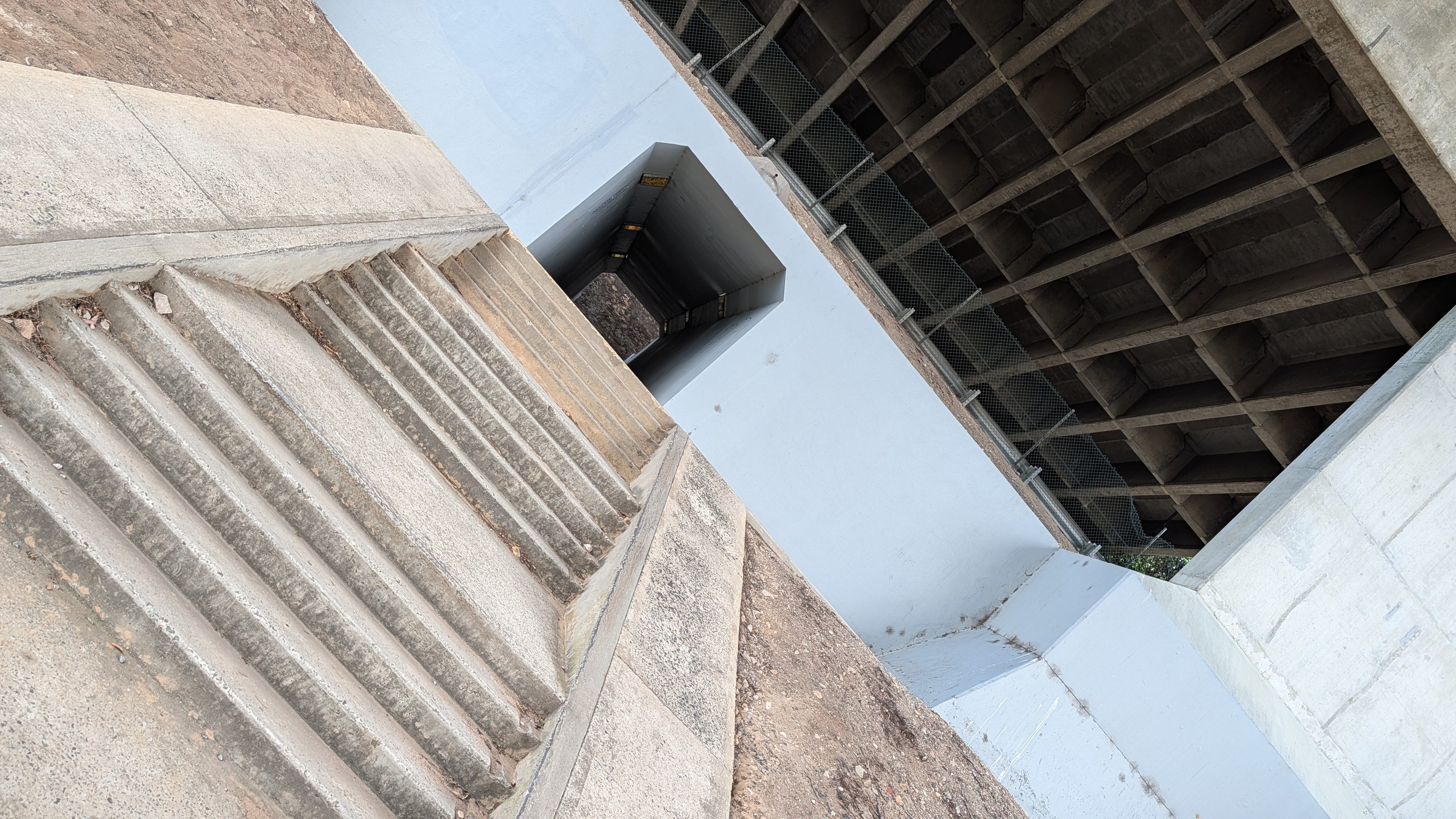
Entering the Gladesville Bridge path is famously convoluted. Exit Huntleys Point Road and head into the tunnel path fitted with steps and a walking ramp. From there, bear to the right—it is critical that you take the cycle path on the eastern side of the bridge. Once through, remount and tackle the climb up and over the soaring concrete arch.
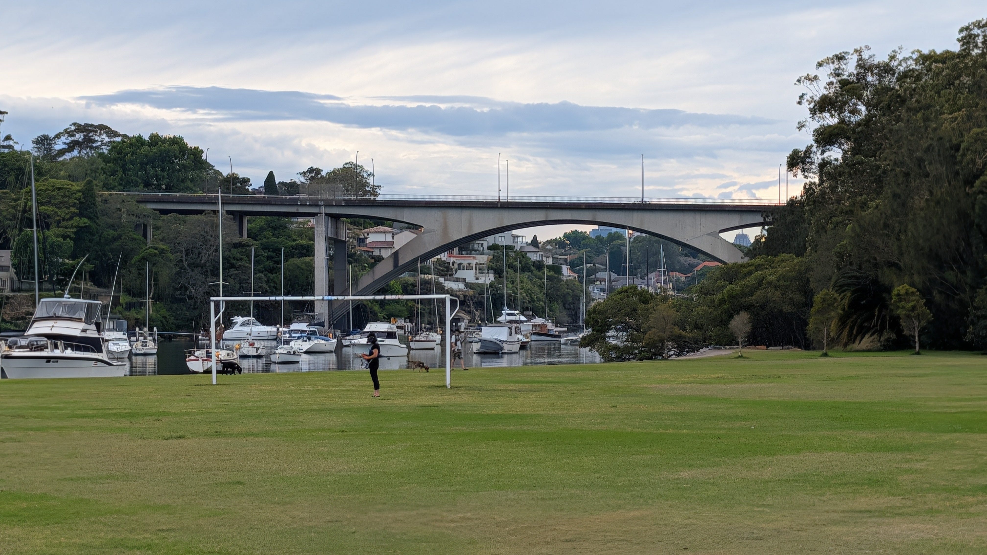
The massive Gladesville Bridge
Head to the right after going thru the tunnel on the North Side
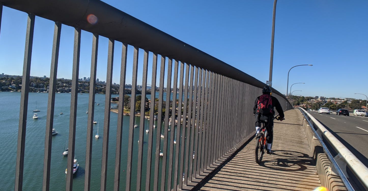
Crossing the Gladesville Bridge is an exhilarating experience high above the harbour, accompanied by the thundering roar of traffic on Victoria Road. Once you descend the southern side into Drummoyne, you need to make a sharp U-turn back down toward Drummoyne’s local street network.
Follow the city-bound wayfinding signs through the backstreets along Wrights Road and Renwick Street. When you see the signs toward the Birkenhead Point shopping precinct, go west towards Victoria Road and cross Iron Cove using the magnificent old steel bridge.
At Terry Road, where the Victoria Road cycleway deteriorates from average to outright appalling, Ride 23 officially wraps up!
The harbour views through the massive fence on the Gladesville Bridge
Things to Note Along the Way
Cycling Infrastructure: The Pittwater Road shared path was recognised in the Sydney Cycling Infrastructure Awards in 2021. Subsequent upgrades have made Pittwater Rd significantly better to ride, especially on the southern end and near Epping Road
Victoria Road Realities: While the connection through Gladesville and Drummoyne toward the bridges is direct, riding directly along the Victoria Road in Balmain is unpleasant. A story for another day.
Ride 23 Tips
⚠️ Note on the Pittwater Road Shared Path: When descending the shared path, take it real easy. The path runs right along busy Pittwater Road. Keep a sharp eye out for fallen sticks, wandering dogs, and errant pedestrians—do not barrel down!
Bridge Entry Navigation: The approach into Gladesville Bridge involves tight ramps and steps. You need to be on Huntleys Point Rd to find the entrance. NEVER EVER RIDE ON THE WEST SIDE.
E-Bike & Wet Weather Caution: The tight wooden bridge climbing out of Tarban Bay is slick when wet.
Family Explorers: The Field of Mars, Buffalo Creek Reserve learn-to-ride track, and Boronia Park BMX dirt jumps make interesting venues for children.
Extensions
If you have plenty of fuel left in the tank, your finish point at Birkenhead Point provides an effortless connection to the famous Iron Cove cycleway. You can simply duck underneath the bridge and roll straight onto the scenic, flat 8 km loop around the bay, which also links up directly with the GreenWay heading south.
📍 Ride safe: These maps are just digital breadcrumbs from my personal rides. Infrastructure changes, so trust your eyes over the screen. Disclaimer and About page
FINAL ENCOURAGEMENT: CONQUER THE BIG ARCH!
From peaceful creek beds and flying fox colonies to sweeping harbour panoramas atop the Gladesville Bridge, this ride showcases the contrasts that make cycling around Sydney rewarding. 🚲
This Substack is reader-supported. To receive new posts and support my work, consider becoming a free or paid subscriber.
Are there any plans to improve the ramp to the tunnel under the Gladesville Bridge? For older riders with heavy e-bikes, it's a killer and the 'walking' ramp is narrower and steeper than in the photo. Then even if you manage to get up to the main road, one still has to cross lanes of traffic to get to the other side, the whole section from the ramp to the road just scares me!
Good write-up. Cruising down Tarban Creek is a delight. As an alternative I've then gone up to Vic Rd after Waruda Place and over the overpass, coming then to the bridge from the other end of Huntley's Point Rd. Shorter, steeper.
I ‘rode’ the western side of Gladesville Bridge once and echo the message here. It's super narrow with projecting structural elements that make it very not safe, rather terrifying and liable to give you bashed ankles at least. And by the time you realise you're stuck it's too late to turn around.


Are there any plans to improve the ramp to the tunnel under the Gladesville Bridge? For older riders with heavy e-bikes, it's a killer and the 'walking' ramp is narrower and steeper than in the photo. Then even if you manage to get up to the main road, one still has to cross lanes of traffic to get to the other side, the whole section from the ramp to the road just scares me!
Good write-up. Cruising down Tarban Creek is a delight. As an alternative I've then gone up to Vic Rd after Waruda Place and over the overpass, coming then to the bridge from the other end of Huntley's Point Rd. Shorter, steeper.
I ‘rode’ the western side of Gladesville Bridge once and echo the message here. It's super narrow with projecting structural elements that make it very not safe, rather terrifying and liable to give you bashed ankles at least. And by the time you realise you're stuck it's too late to turn around.
The east side is gorgeous though!