Remapping the City, Exploring the East, and Riding Together
Your June Update on our transition to 66 long-form rides, exploring Eastern Sydney, and hitting the tracks.

Part 1: The Map Always Comes First
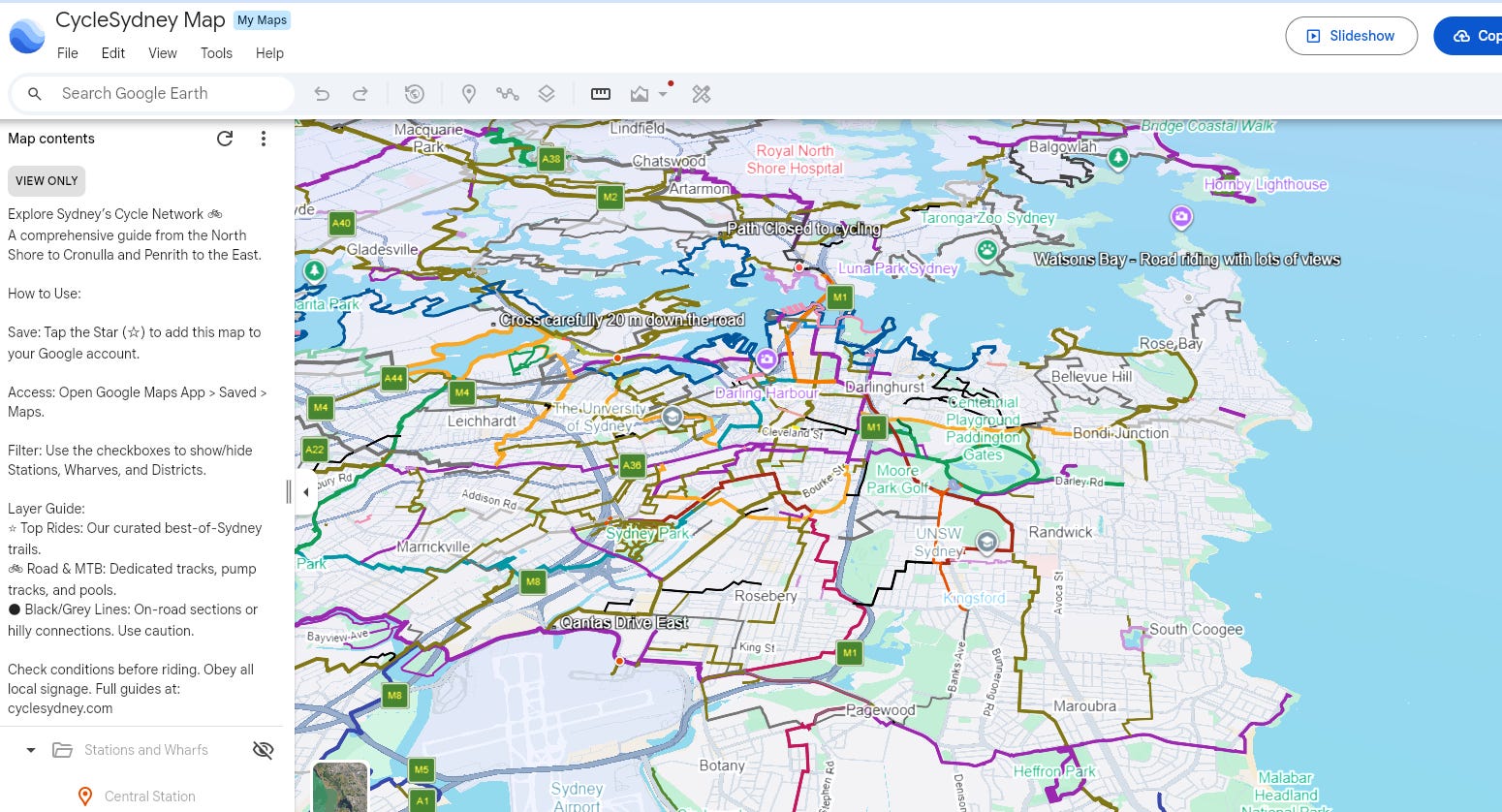
As we grow into 2026, let’s wrap up how things have gone this year at Cycle Sydney. First of all, we have to think about the map, because the map always comes first.
Before the start of the year, the map consisted of segments broken up into “Great,” “Pretty Good,” and “Okay”. The “Great” shared paths purple were the ones you’d be happy riding on with your kids and partners. The “Good” paths, marked in olive green, were lovely roads where you’d feel happy riding as a cyclist, but maybe wouldn’t take your friends on too often—like Belmont Street in Alexandria.
This year, we are taking a much longer approach to these rides. Instead of just segments, we are finding all the Great ones, joining them with Good ones and creating a map of long-form rides, starting right in the center of the city and spreading out. The newer rides intersect or end at the city rides if they can, creating a sort of “onion peeling effect” as you navigate outward. As we head further West, we are starting to use the exact same technique moving from Parramatta outward.
Think about this: the total number of rides we have reconstructed for the map this year has reached 66. With an average length of about six kilometers, we are up to 400 km of pretty good cycling—and trust me, we are going to be well over a hundred rides once everything is complete and remapped.
The other notable change to the mapping is also putting the Rides into RideWithGPS collections. RideWithGPS is popular with cycling groups across Sydney (especially BikeNorth).
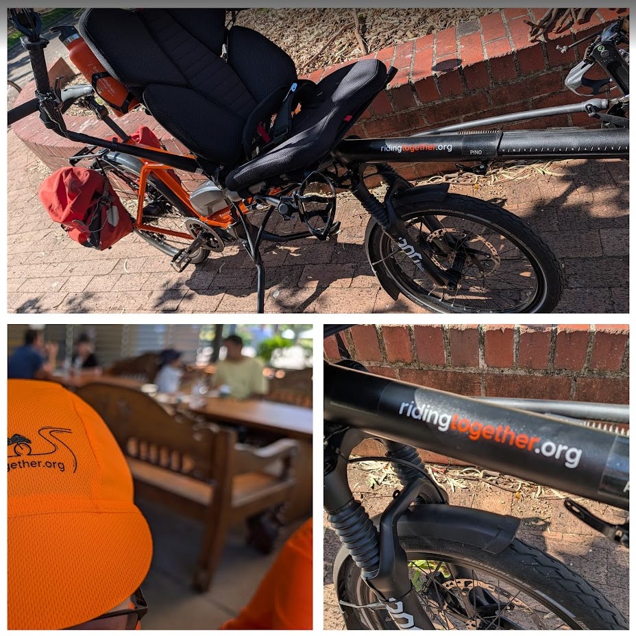
Giving Back with Electric Tandems One of the things I completely didn’t expect when setting up Cycle Sydney on Substack was the financial support that has been arriving from folks who like my stuff. It is incredibly motivational. Because of this community backing, I am making it a rule to give a bit back. This month, I’ve directed some of those funds to a small cycling charity that uses electric tandem bikes to take people with sight impairments or balance issues out cycling. I’ve actually ridden with these guys; it’s a fantastic cause, and running those electric tandems is not cheap. Thank you to paid subscribers of this channel for supporting cycling across Sydney ! Garry
Part 2: Breaking Down the Areas
So, we are organizing all of this into 6 areas across Sydney. These boundaries sort of match up with the local council areas, but really, they are defined by the topography.
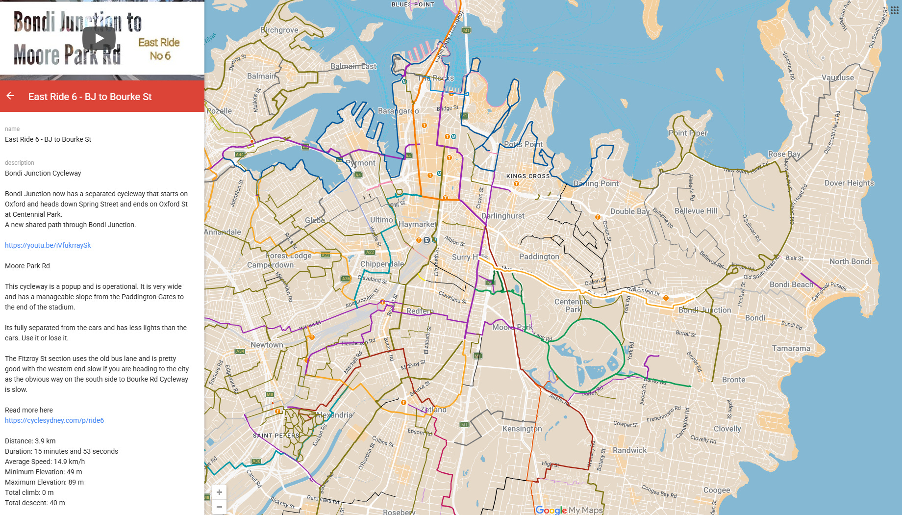
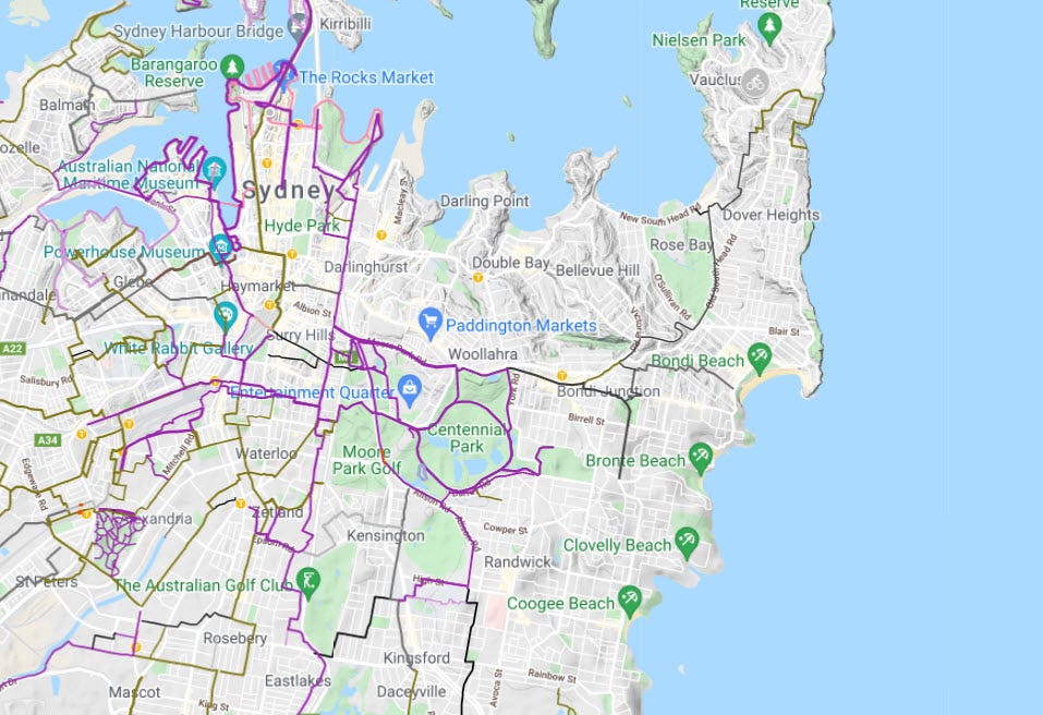
So far, we have written up the City and the East. I covered the City page a while back, but now we have progressed to writing up quite a few rides across Eastern Sydney.
If you look at the map for the East, you’ll see some great examples. We have the ride from Bondi Junction to Bourke Street. There’s the fabulous Queens Park ride that goes down and around the complete Centennial Park before heading to Bourke Street again. We also mapped the Rose Bay ride and posted it recently. It starts at the Double Bay wharf, runs down along the water at Rose Bay, loops around the back of Royal Sydney, and features a “not for kiddies” ride up to Bondi Junction and over to Waverley Park. Another new post one is the ride from Port Botany, taking the pedestrian bridge over the railways, and heading up through Eastlakes, Rosebery, and into Zetland.
Those are examples of the rides in the East—check the area page for more.

I hope you are enjoying all the posts that have been coming out this year. Remember, the goal for you and I isn’t just sitting at home consuming cycling motivation. The goal is getting out for a cycle, exploring, getting lost, finding your way again, and then relaxing into more motivational stories from Cycle Sydney.
All the best! Garry.
There are 417 subscribers to CycleSydney.Com
Our Map has been used 2.8 million times
We have 10,000 followers on FaceBook
Our new substack subscribers come from Search and Facebook mostly
If you search on the web or use AI use “cyclesydney xxxxxx” to find our stuff 😁

Go Crazy - If you see View in Google Earth link at the bottom left of the map page, you can see the map in 3D - even Satellite mode