
City of Sydney Bike Rides & Cycleways
Your Hub for City of Sydney Cycling: Routes, Maps, and Local Insights

As fun as this post was. We have moved on to a hub page
Welcome to the Cycle Sydney hub for the City of Sydney, your comprehensive resource for mastering the city's bike network. This page brings together the best urban bike routes and separated cycleways to help you navigate the heart of Sydney safely and efficiently. We are currently building out a complete series of local guides, with 10 ride articles already featured—ranging from Ride 1 through to Ride 15—and only two more to go to complete the set. Whether you’re a daily commuter or a weekend explorer, our detailed route insights ensure you have the best information for every journey. Dive into our ride guides below and discover why the City of Sydney is one of the most exciting places to explore by bike.
What follows is literature and videos from the recent days when this site was a Wiki
All the articles on The City area can be found here
https://www.cyclesydney.com/t/city
The City of Sydney is one of the better inner cities for cycling in the world. This page covers the City Centre and all of these suburbs – These are all managed by the City of Sydney council and this is the Council’s cycling page. They have a great team dedicated to active transport and they lead the way in NSW.
Riding around and staying away from cars is difficult, hopefully this page will help you out. The easier way is just to ride early Saturday or Sunday morning before everyone heads out for morning coffee.
Here is a playlist of videos in the city of Sydney area and one more link to the CycleSydney map zoomed into the City of Sydney

City Ride 1 – Bourke St to Pitt St
Read more and find the GPS of the ride here
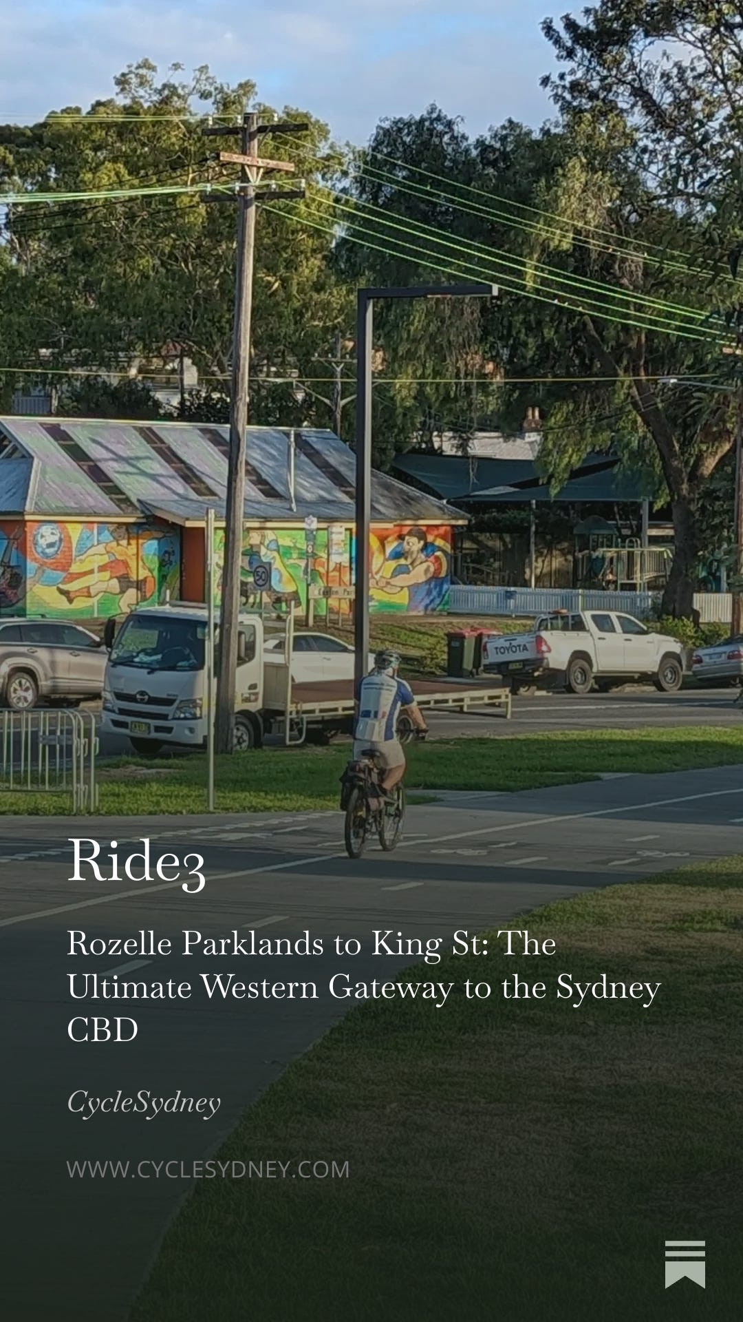
Ride 2 – Waterloo station to Castlereagh Street via Prince Alfred Park
This ride offers an excellent connection from the inner-south to the Sydney CBD, largely utilizing dedicated cycle infrastructure. Starting from Waterloo Station, the route quickly transitions onto George St in Redfern, a popular cycling artery. It then flows through the green spaces of Prince Alfred Park and proceeds along the east side of Central Station, passing Belmore Park. The final and most significant segment of the journey is on Castlereagh Street, which now features a terrific inner-city cycleway, providing a safe and efficient run directly to the intersection with King St. This ride provides a clear, separated path through several key inner-city landmarks.
See an arial of the ride and find the RideWithGPS here
See an 3D view of the ride from Rozelle Park, over the Anzac Bridge and into the city here
Ride 7 – Greenway to Redfern via Newtown
This isn’t a ride about flashy, multi-million dollar “veloways” that run uninterrupted for ten kilometers. This is about the art of the urban commute: mastering the narrow gaps, dodging the arterial chaos of Parramatta Road, and finding the flow state between Lewisham and Redfern.
Other Rides Posted That You May be interested in
Belmont St to Zetland: Inner South Commuter Bike Path
City Ride 5: A 4km well-signposted route from Belmont St to Zetland. A quiet, inner-south path through Alexandria’s backstreets with key cross-city links. https://cyclesydney.com/p/ride5
Zetland to Newtown: The Green Square & Alexandria Link
City Ride 9: A trek from Zetland to Wilson St. Avoid McEvoy St traffic with this route through Gadigal Ave, Green Square, and Alexandria’s backstreets.
https://cyclesydney.com/p/ride9
Sydney Harbour Bike Tour: Rushcutters Bay to Rozelle Bay
City Ride 10: An iconic photography-focused ride through Elizabeth Bay, Mrs Macquarie’s Chair, past the Opera House, and Barangaroo to the new Sydney Fish Markets.
https://cyclesydney.com/p/ride10
Wilson St to the City: The Goods Line & Darling Harbour Link
City Ride 11: A 3.5km link from Wilson St through Chippendale and the Goods Line to Darling Harbour. The essential path to the Western City Kent St cycleway.
https://cyclesydney.com/p/ride11
Airport to Waterloo: The Bourke Road Link
City Ride 10: A vital connection from the Airport and Cooks River through Mascot and to the heart of the inner-city cycle network at Redfern
https://cyclesydney.com/p/ride13
The Inner City
Sydney is increasingly embracing cycling as a key mode of transport and recreation. Beyond the impressive cityscape and established infrastructure, discover the growing network of cycling paths and initiatives making it easier than ever to explore the city on two wheels. This page provides comprehensive information on cycling in Sydney, alongside its other attractions and amenities. Lets have a look around
Darling Harbour
Check out The Goods Line and then ride through Darling Harbour to Barangaroo
Darling Harbour is not a fast ride but it sure is scenic
If you can get out early, this is a fabulous ride. Once the tourists and workers start heading off for lunch, the crowds are huge. Its dead flat, the trail is generally loaded with people, there is a bit of road riding near the bridge.
See photos of Darling Harbour here A most appealing 10km each way ride that takes you from the Anzac Bridge in Pyrmont to the Sydney Harbour Bridge via Darling Harbour. The photos explain the obvious, its a worthwhile ride for locals and tourists. What you have to think about is How am I going to get there? When is a good time to go? Lets start with the getting there. If you were to come by train with your bike, you could get off at Wynyard, Circular Quay and Milsons Point. Town Hall could also be an option but its a bit trickier. From Wynyard Station head to Barangaroo. From Milsons Point, head up to cross the bridge on the western side and from Circular Quay, carefully make your way around to the base of the bridge and you are away. If you come by car, best parking would be Glebe and there is metered parking around Pyrmont. Now what is the best time to come? You really need to be there when everyone is not interested, so arrive early on the weekend or when its cold or raining. Otherwise you will have a good time but you will have to dodge a lot of people. You probably won’t do this so your best riding is closer to the Anzac bridge through to the Harbour Bridge and slowly through to the Opera House. Naturally travel on trains and but coming in by cars to the adjacent suburbs is much better when its early. Forget train travel in peak time with your bike, you will need a fold-up bike. From the Anzac Bridge right around to the end of Darling Harbour, you can ride freely on the super wide paths. Don’t plan on going fast, lots of people. Once you pass the Casino at Barangaroo, the trail opens up a bit and the lack of shops makes the riding easier though it still can be busy. Its good fun riding around Barangaroo and when you travel onwards to the Harbour Bridge you need to ride in a cycle lane on a road. This is pretty good on the weekend as the road is very wide. During the week it will be worse. An alternative is to ride around some of the wharfs near the bridge, a bit bumpy but fun. This ride is suited to all bike styles.
Pyrmont
This suburb is for exploring – this video of snapshots will give you a taste. Here is a video of a sneaky way from Harris St to Darling Harbour
Bourke St North
The Bourke Street Cycleway from Woolloomooloo to Taylor Square is an important part of getting around the east, especially if you live in Potts Point, Kings Cross and Woolloomooloo and want to get to Lady Macquarie’s Chair or the north end of the city. Starting in Woolloomooloo, cyclists can enjoy the cool morning breeze along the waterfront. Riding towards Surrey Hills, first up you will find a turnoff to a small lift and a bridge over the freeway that takes you to the museum and the Brett Whitely Matchsticks. Further up you can head up Cathedral Street to join the cycleway through The Domain. Approaching William Street, it’s important to stay alert for cars turning into the tunnels. On the way you will enjoy the mini green spaces and charming two-story terraces. Watch this video to find out.
Wilson St – Redfern Station and Central Station
What a marvellous shared path this is. It starts at Redfern Station and heads most of the way to Newtown where the western side of the road goes up the one way road. Here it is viewed from a Brompton folding bicycle Here it is on the CycleSydney map >>
Just to the north is Central Station which you get to riding up George St and thru Prince Alfred Park. Check out what it is like to ride past Central station on the East side. It is good fun and amazingly smooth for such a busy area Map Link >>
Belmont Rd – Alexandria
Starting on George St in Waterloo, heading past the Metro Station, past Alexandria Park. Then a lane takes you to Belmont St which has these two wonderful dead-ends that you can ride on thru.
Newtown to Stanmore
Great narrow road riding and then a terrific cycleway into Stanmore.
Sydney Park
If you live near Erskineville or are on a trainline to St Peters Station, Sydney Park is a place for a bit of casual bike riding. Ten years ago, we regularly used to head to Sydney park because they have a great traffic light bike park for the kids. Our kids also used to enjoy a big hill where they could roll down and there is lots of grass to kick a ball. Nowadays the whole park is a mecca for walkers, kids cyclists, skateboarders and dog lovers. Its also a very pleasant place to ride a bike if you enjoy the experience of going slowly past the 101 Dalmatians. It can also be great place to practice short hill climbs. The paths up the hill tend to be a lot emptier and if you want real exercise, 20 times up the five different tracks will sort you out more than a tread mill.
See photos and See the map, tracks criss-cross the park >> Given that two times around the park is only 6 km’s of riding, you should head down Huntley St to get to the markets and cafes of “The Mills Of Alexandria”. Take a bike lock if you go there as you cannot drag the bike into the cafe areas or markets. Once you are on Bourke Rd, head south down the special bike bath and you will be at Mascot Station and then the bike trail to Brighton le Sands. Anyone on the Cooks river can ride down that trail to Mascot then Bourke Rd and end up in Sydney Park, have a snack and then catch a train home from St Peters station. St. Peters Station has quite a few steps to get to all platforms and no lifts. Starting at the Northern Carpark and heading in a clockwise direction
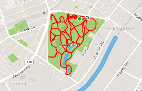
Here is a challenge, ride all the tracks and do it in less than 10 kmExternal Links: Sydney Park is home to Sydney Cycleways and their program of bike maintenance and bike skill workshops. There is now a giant skateboard park and a small kids cycling track.
See a video about cycling to the Cahill-expressway
Read how you can beet the bus from Alexandria to Darling Harbour
Here are all the videos to give you an idea of what is around the city
Read about the Sydney Airport and Cooks River here or Read about the Grizzly history of the Alexandra Canal here
Viewing The Harbour Bridge and Opera House
Ride down Pitt St from the city, arrive on a train, ride around from Barrangaroo (metro). You are totally allowed to ride under the harbour bridge and around to the Opera House. What you cannot do is ride in the botanical gardens. Another alternative is to view the Harbour Bridge from above the crowds and then ride to the bridge using the the shared path on the Cahill Express Way.
Look for Circular Quay on the map>>
Keep reading with a 7-day free trial
Subscribe to CycleSydney to keep reading this post and get 7 days of free access to the full post archives.